Universal polar stereographic coordinate system
The universal polar stereographic (UPS) coordinate system is used in conjunction with the universal transverse Mercator (UTM) coordinate system to locate positions on the surface of the Earth.
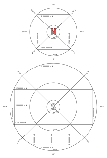
UPS covers the Earth's polar regions, specifically the areas north of 84°N and south of 80°S, which are not covered by the UTM grids, plus an additional 30 minutes of latitude extending into UTM grid to provide some overlap between the two systems.
In the polar regions, directions can become complicated, with all geographic north–south lines converging at the poles.
Specifically, the projection used in the system is a secant version based on an elliptical model of the earth.
As with the Mercator projection, the region near the tangent (or secant) point on a Stereographic map remains very close to true scale for an angular distance of a few degrees.