University City, Philadelphia
The eastern side of University City contains the Penn and Drexel campuses, several medical institutions, independent centers of scientific research, 30th Street Station, one of the nation's busiest passenger train stations, Cira Centre, and Cira Centre South.
[4] Before the European colonization of the Americas, Philadelphia was home to the Lenape people, whose land, known as Lenapehoking, covered much of the Atlantic coast from western Connecticut to Delaware.
In 1677, William Warner purchased 1,500 acres (6.1 km2) from the local Indian tribe and named it Blockley after his native parish in England.
"It was an ideal hideout for shadowy characters and evil-doers who crossed the river in skiffs after a thieving or smuggling job south of the city.
The gardens is now the Woodlands Cemetery, while much of the rest of Hamilton Village is covered by the 40th Street retail corridor.
[9] Situated near Lancaster Ave., Powelton Ave., and Market St., Greenville served as a waypoint for travelers and cattle drivers, and many taverns and inns were established.
[10] The arrival of electrified streetcars in the 1890s kick-started development to the west of 43rd Street, and bridges and a tunnel in the first decade of the 20th century allowed people to easily commute into Center City.
[19] As part of the Housing Act of 1949, Congress established the "Slum Clearance and Community Development and Redevelopment" program, commissioning federal funds to "assist local communities in eliminating their slums and blighted areas and in providing the maximum opportunity for the redevelopment of project areas by private enterprise.
This power to take land reached University City when The West Philadelphia Corporation (WPC) was formed in 1959 by a group of local institutions including Penn.
By 1965, the WPC had developed a plan to demolish homes in Unit 3 and redevelop the land into a center of private scientific research, an expanded hospital, and a large new high school.
[23] Within four years, the University City Science Center had been established and most of the buildings on Market St. between 34th St. and 40th St. had been demolished.
Much of what is now the center of Penn's campus, including Locust Walk and Superblock, was part of the redevelopment of Unit 4.
Along the west bank of the Schuylkill River lie several large parcels of land that have historically seen large-scale non-residential use.
As of the 1960s, the most prominent uses of this area were for Philadelphia's main train station, post office, and civic center.
A small part of this area was used to build the Cira Centre, a 29-story, crystal-shaped office tower with distinctive LED lighting visible at night.
Beginning in 1991, Penn publicly expressed official interest in acquiring the 19.2 acres (78,000 m2) to the southeast of its campus occupied by the Philadelphia Civic Center complex.
[31] The initial plans were not fully developed, but did not call for the demolition of Convention Hall, the location of several historic events.
[32] By 2005, plans had been expanded and the whole site, including Convention Hall, was slated for demolition to make way for a new clinical care facility attached to the hospital.
[33] Some were mollified by an exhaustive study commissioned by Penn to find alternate uses for the buildings and demolition continued.
(A 1994 map[37] shows the area before the GE building was refurbished into the Left Bank and the Cira Centre was built.
[39][40][41] Two new towers replaced a one-time truck annex for the Post Office and now include the headquarters for the FMC Corp., a parking garage with a green roof open to the public, an apartment building, and street-level retail.
The racial makeup of University City was about 42% Black, 35% White, 18% Asian/Pacific Islander, 4% Hispanic, with the remainder not classified.
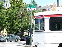
The area is served by four distinct types of passenger rail transportation: intercity, regional, metro, and trolley.