Uthlande
The local North Frisians became direct subjects of the Danish king and fought for him against the Holy Roman Empire and Holstein.
His brother, killer and successor Abel even lost the greatest part of his army and his life when he tried to again enforce the plogpennig in Frisia in 1252.
Until 1284, central administrative powers had become established in a way that Valdemar IV, Duke of Schleswig was able to contract a treaty with Bremen in the name of the Frisians.
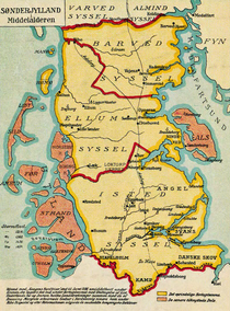
During the Middle Ages, the following Hundreds (Harden) were part of the Uthlande: This list of areas varies according to sources and years and the shape of the coastline has changed considerably during the last centuries.
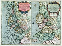
Important sources include the Danish Census Book of king Valdemar II of Denmark, and historicising maps by Johannes Mejer (printed in 1652).