State Route 74 (New York–Vermont)
NY 74 begins at exit 28 off Interstate 87 (I-87) in the hamlet of Severance in the Adirondack Mountains region of the northern part of New York State.
The ferry connecting the two highways, predating both NY 74 and VT 74, began operation in 1759 on an informal basis.
The New York portion of the cross-state Route 74 west of Ticonderoga was designated as part of NY 73 in the 1930 renumbering of state highways in New York, while the Vermont section carried several different designations from the 1920s to the late 1930s, when it became solely part of Vermont Route F-9.
The starting interchange is close to local landmark Severance Hill, which reaches an elevation of 1,600 feet (490 m).
The highway meets a few local road intersections just south of Goosebury Hill before encountering Paradox Lake.
NY 74 runs mostly parallel to the lake and intersects with a local campground entrance road as it continues eastward from Schroon.
[6] Cotters Pond is a small landmark located beyond a few mountains and hills on the southern side of NY 74 near the end of Paradox Lake.
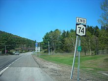
The New York portion of NY 74 terminates at a ferry landing by Lake Champlain at the state border.
[9] The current ferry barge, in operation since 1959, is powered by a sixteen-ton tugboat built in 1979 that can hold up to 18 cars.
[8] After crossing the state line via the Fort Ticonderoga–Larrabees Point Ferry, VT 74 begins its track into Vermont.
The highway heads a short distance to the north, passing a thinly populated area in Shoreham, as intermittent forest yields to fields and farmlands.
At the intersection with Blue Harbor Road, VT 74 turns to the east and heads toward downtown Shoreham.
The area's first municipality was the town of Crown Point, which originally included considerable portions of thinly populated land that later developed into separate townships.
One of these old state roads traversed the route covered by the current alignment of NY 74 from Schroon to Ticonderoga.
[23][24] The Blue Ridge Road is now designated as CR 84 from NY 28N in Tawahus to the Adirondack Northway in North Hudson,[25][when?]
[26] On the Vermont side, the road connecting Larrabees Point to the main north–south highways in the area was designated as VT F-9 by 1926.
[5] NY 73 was truncated to its current eastern terminus in Underwood on July 1, 1972, eliminating a lengthy overlap with US 9, while its former routing from Schroon to Lake Champlain was renumbered to NY 74, matching the other Vermont route number that ends in Larrabees Point.
[35] The New York State Department of Transportation has announced a project to repave NY 74 from Chilson to Paradox.
The project is in preliminary development, with construction is expected to begin in early 2013 and reach completion about a year later.
This vessel was about 30 feet (9.1 m) long, with a mainsail that would swing completely around the mast to provide a simple means of reversing course.
[9] John S. Larrabee of Vermont established the first regular ferry at the location in the late 18th century.