Vestmannaeyjar
Vestmannaeyjar came to international attention in 1973 with the eruption of Eldfell volcano, which destroyed many buildings and forced a month-long evacuation of the entire population to mainland Iceland.
Approximately one-fifth of the town was destroyed before the lava flow was halted by application of 6.8 billion litres of cold sea water.
The islands lie in the Southern Icelandic Volcanic Zone and have been formed by eruptions over the past 10,000–12,000 years.
Basalt columns can be seen in many places, and the sea has eroded the soft rock of the shoreline and scooped out many picturesque coves and grottos, which are among the special features of the islands.
It lasted about four years – one of the longest in Icelandic history – and gave birth to Surtsey, the 15th island in the group.
The two main commercially exploited species in Iceland, cod and haddock, are found in abundance in Vestmannaeyjar.
The islands enjoy the country's highest average annual temperature, the Gulf Stream having a strong warming effect, especially in winter.
Not long after Ingólfr Arnarson arrived in Iceland, his blood brother Hjörleifr Hróðmarsson was murdered by the thralls he had brought with him.
After this, a small fort was built on Skansinn (that is, "the bastion"), and an armed guard was established to keep watch from the mountain Helgafell for the approach of ships.
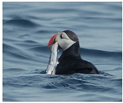
For centuries, the people of the Vestmannaeyjar had a hard struggle for existence, living from fishing and wild birds and their eggs, which they gathered in the cliffs and rock stacks offshore.
Shortage of fresh water was also a problem for a long time, but a great improvement took place in 1968 when a pipeline was laid.
[14] A new hybrid electric ferry with a 3 MWh battery and capacity for 550 passengers and 75 cars started operating the 13 km route in July 2019.
Vestmannaeyjar residents had been prevented by bad weather from sailing to the mainland for the festivities and thus celebrated locally.