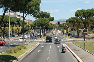
Via Cristoforo Colombo
With its 27 kilometres (17 mi) length it is the longest Italian road among those included within the borders of a single municipality and, in several stretches, the largest in Italy.
Via Cristoforo Colombo starts from Porta Ardeatina and continues south-west, ending on the coast in the district of Castel Fusano.
[1] It starts from the Aurelian Walls, close to Porta Ardeatina, and goes southward, soon trespassing a stretch of the bypass (Via Cilicia) and the rail circuit near the Roma Ostiense railway station.
At Piazza dei Navigatori it turns westward, running along the Palace of Lazio Region on the right and the former Fiera di Roma.
Starting from Via del Risaro it runs along the presidential estate of Castelporziano, then reaches Casal Palocco and, after passing the pine forest of Castelfusano, ends in Piazzale Cristoforo Colombo in Ostia, close to the railway station with the same name.