Viktoriapark
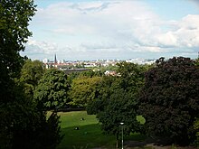
[1] It is situated on the Tempelhofer Berge range, forming the northern slope of the ground moraine Teltow Plateau, overlooking the glacial valley with Berlin's city centre.
A historic wine-growing area, today the park is neighbouring two small vineyards, one in the northeast founded in 1968 and owned by the Senate of Berlin and cultivated by the adjacent market garden, the other one established in summer 2006 within the Victoria Quarter on the southern slope of the Kreuzberg hill.
[2] However, only the old vineyard provides for the local "Kreuz-Neroberger" wine, gained from vines donated by Kreuzberg's twin towns Wiesbaden (1968) and Ingelheim am Rhein (1975), as well by the Bergstraße county (1971 and 1973) and from Bad Bergzabern (1985).
As the surrounding area incorporated into Berlin in 1861 as Tempelhofer Vorstadt had become a densely built-up suburb, in 1879 Guido von Madai, president of the royal police, decreed a maximum height of buildings in the adjacent streets to uphold the visibility of the monument.
[4] The ordinance, however, was annulled by the groundbreaking 1882 "Kreuzberg judgement" of the Prussian Royal administrative court, stating that the police had exceeded its authority to ensure public security.
[9] Using the topography of a former sand pit Mächtig designed a highland-like waterfall on the northern slope of the Kreuzberg directed in its axis towards Großbeerenstraße, named after the homonymous battle.
[11] Whereas some authors claim the Kreuzberg waterfall was modelled on the Zackel Falls in then Steinbach (renamed Kamieńczyk after 1945) in Lower Silesia,[9][10][12] Nungesser is doubting that.
[8] Gas motors in a neighbouring machine house (now the venue hall of the restaurant in the Villa Kreuzberg, the former engineer's home, an ensemble built 1892–1893 by Hermann Blankenstein[14]) pumped up the water.
Mächtig's park design, using the natural and anthrogenous topography of the Kreuzberg hill, resulted in the current mountainesque character with varied landscape forms, forested steep slopes, tiny terraces, outlooks, sodded hillsides, interrupted by trees and bushes and connected by paths, ramps, serpentine switchbacks and stairs.
[18] In the late 1890s six herms of „poets and singers of German patriotism“[16] have been raised, to wit Ernst Moritz Arndt (1899 by Hans Latt), Heinrich von Kleist (1898 by Karl Pracht), Theodor Körner (1899 by Ernst Wenck), Friedrich Rückert (1899 by Ferdinand Lepcke), Max von Schenkendorf (1899 by Alfred Reichel) and Ludwig Uhland (1899 by Max Kruse).
The then planned axis consisting of a promenade and series of waterfalls cascading down the Kreuzberg hill towards the square was never realised, the interjacent block of houses remained untouched.
[27] In summer 1944 the Organisation Todt, also employing Soviet forced labourers else held captive at Blücherplatz, started driving five tunnels into the northern Kreuzberg slope from Kreuzbergstraße.
[29] On 30 January 1944 British bombs left behind a wake of devastation leading from one block north up the Großbeerenstraße, over the waterfall - destroying its pumphouse - to the monument, blasting away the southern edge of the octagonal socket structure then used as a safe place for casts of various sculptures, such as the Quadriga of the Brandenburg Gate.