Snicker's Gap Turnpike
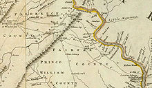
In the late 18th century, there were two roads over the Blue Ridge Mountains between Alexandria and Winchester, crossing at Snickers Gap (now along State Route 7) and Keyes Gap (State Route 9).Thomas Jefferys, 1776, A Map of the most Inhabited part of Virginia, drawn by Joshua Fry and Peter Jefferson in 1775, London: Sayer and Bennett The Virginia General Assembly, in 1785, passed a law appointing nine commissioners (a non-profit turnpike trust) and instructing them “to erect, or cause to be set up and erected, one or more gates or turnpikes across the roads, or any of them, leading into the town of Alexandria from Snigger’s [Snickers] and Vesta’s [Keyes] Gaps”.
This was not the first law authorizing a toll road in the United States,[citation needed] but was the first recorded turnpike in operation, opening by the end of 1786.
Richmond: Commonwealth of Virginia., p. 15 but instead transferred this short stub (Clayton Hall Road) to the secondary system in 1943 due to low traffic.State Highway Commission of Virginia (May 12, 1943).
The 124-foot (38 m) long by 22-foot (6.7 m) wide (38 m by 7 m) stone double-arch Hibbs Bridge (39°02′14″N 77°43′23″W / 39.037332°N 77.72303°W / 39.037332; -77.72303) over Beaverdam Creek between Mountville and Philomont, built ca.
(1.27 MiB), January 2001 The Snickersville Turnpike Association, organized to prevent the replacing of the bridge, has more recently opposed other developments such as cellular towers,Michael Laris, Board Rejects Cellular Tower, ‘’The Washington Post’’, March 8, 2001, p T1 in addition to continuing to participate in matters related to the bridge.