Viswema
Viswema (/ˈviswɛmə/) is a Southern Angami Naga village in the Kohima District of the Indian state of Nagaland.
With a resident population of 7417, it is the second biggest village in the state and is part of the contiguous built-up of the Kohima Metropolitan Area that extends into the neighboring areas of Jakhama, Kigwema and Khuzama in the Southern Angami region, forming the second largest urban agglomerations in Nagaland.
Its vast territory also lies across the inter-state boundary in Manipur where notable features including Mount Tempü (Iso) at 9822 feet (2994m) also the highest peak in Manipur, the thick forest of Kezol-tsa and a major portion of the Dzüko Valley is located.
[1] Traditionally referred to as Viswe–ra, a name given by its historical ancestor Keyho which loosely translates to as ‘A place of people with Virtue and Integrity’.
Viswe was a descendant of Keyho, who migrated from East Asia crossing Burma, Manipur and finally settling in Viswema.
The defeat inflicted on the Burmese invaders gave a sense of confidence and Viswe–mi became more assertive and grew in great numbers.
So the entire village intellectuals gathered around to figure out what it meant until someone stood up and said “it means they will burn down our village to ashes.” And so the Viswemis agreed to this and sent the messenger back to Manipur with grinded Naga King Chilly tied in the same piece of cloth meaning “Attack us if you want to know what pain feels like.” — Oral history[a] The Manipuris invaded Viswema twice, but could not succeed in subduing it.
However, after the end of the Anglo-Naga War in 1879 the British occupied Kohima and set up a military post and built strong barricade around the station with armed police.
The Manipuri Raja Chandrakirti Singh led around a thousand of his army and rushed to Kohima and after a brief engagement with the Naga warriors lifted the sieged and saved the British.
The Manipuri Army went on a rampage and captured a Kohima boy and buried him alive in the heart of the town.
[2] When the Japanese and INA soldiers entered Naga Hills in early April 1944, many of them stayed at the outskirt of the village.
Bombings on 14 June continued till the village which had more than 600 houses at that time was completely razed to the ground.
The same evening the Japanese forces at Viswema retreated to the route by which they had entered Naga Hills two months back.
He observed,“The art of peace making is much more difficult than the science of war.” The two resolutions passed at the session were: reaffirmation of A.
The family names of the Yeri-mi clan are: Viswema is situated at 1,631 m (5,351 ft) above sea level on the eastern part of the Barail mountain range.
It is bounded on the west by Zeliangrong villages, on the north by Jakhama, on the east by Kidima, on the south-east by Pudunamei (Manipur) and on the south by Khuzama.
On its southern side, the Dzüko Valley is flanked by the thick wooded Kezol-tsa Forest which has diverse species of flora and fauna.
In Viswema, most people were engaged in the civil service which serves as the main source of its economy.
A large number of Government and Private employees commute to and fro to their workplaces in Kohima daily.
They start collecting wild flowers in advance to decorate the particular Chokrwu (eaves at the entrance of a house) they decide on.
The most common flowers are Khwüso Pü (Ginger lily, Hedychium aurantiacum wall), Phakü Pü (Rock butterfly lily, Hedychium ellepticum Buch), Terü su and Tsakoshe Pitha Nü (Tender Maize).
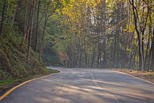
[14][15] The main entry to Dzüko Valley is from Viswema where one can travel to the rest house above Teyozwü by a Tata Sumo taxi.
Viswema falls under the Southern Angami II constituency, of the Nagaland Legislative Assembly.
Pcheda is a traditional game that requires players to throw thin bamboo sticks from a set distance.
The Bir Tikendrajit International Airport is located about 120 kilometres (75 miles) south of Viswema.