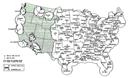
WSR-74
They were added to the existing network of the WSR-57 model to improve forecasts and severe weather warnings.
[2] It also has a dish diameter of 8 feet, and a maximum range of 579 km (313 nm) as it was used only for reflectivities (see Doppler dilemma).
The WSR-74 was introduced as a "gap filler", as well as an updated radar that, among other things, was transistor-based.
[3] In the early 1970s, Enterprise Electronics Corporation (EEC), based out of Enterprise, Alabama won the contract to design, manufacture, test, and deliver the entire WSR-74 radar network (both C and S-Band versions).
They were gradually replaced by the WSR-88D model (Weather Surveillance Radar - 1988, Doppler), constituting the NEXRAD network.
WSR-74 sites include the following two categories:[8][9] Was atop the WSFO building at 3420 Norman Berry Drive Replaced a WSR-3.
Became part of the national network after the WSR-57 at Miami was destroyed in Hurricane Andrew.