Käferberg
601 metres or 1,972 feet) are the summits of a wooded range of hills overlooking the inner city of Zürich, Zürichsee, Albis chain and Uetliberg, as well as the Limmat Valley and the Zürcher Unterland in Switzerland.
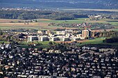
It is located in the Zürich districts of Höngg,[1] Wipkingen and Affoltern,[2] between Bucheggplatz and ETH-Hönggerberg, known as Science City, and the western Hönggerberg heading on the northern border of the Limmat valley to Würenlos.
[4] Another restaurant, a Tennis club and a small TV tower are situated within the woodland at Waidberg summit, nearby the former Freibad (public open air bath) Waidbad which is now a popular pic-nic site, too.
There was a project to renew the Waidbad as a site of wellness, to integrate the area in a so-called "forest spa" including indoor baths, sauna, cafeteria, complete infrastructure and attractive outdoor grounds.
The 2,119 metres (6,952 ft) long Käferberg Tunnel runs under a shoulder of the hill, carrying trains, including those of S-Bahn Zürich lines S5, S6, S7 and S16, between Hardbrücke and Oerlikon stations.