Walking routes in the Palatine Forest
The first are longer walking routes, most of which are maintained by the Palatine Forest Club (German: Pfälzerwald-Verein), or PWV, and which are linked to the national and international network of long distance paths.
The historic, northern route ran along the Speyerbach, through the Frankenweide and the Karlstal valley towards the Landstuhl Marsh, past the pilgrimage church in Vogelbach, via Karlsberg to Homburg and from there via Hornbach Abbey to France.
The E8 European long distance path from Ireland to Turkey runs through the state of Rhineland-Palatinate from the north along the River Rhine to the Donnersberg hill, then via Worms in the Odenwald (Hesse).
The international Donnersberg-Donon long distance path is waymarked by a red bar and runs from Bad Kreuznach through the Donnersberg area and Palatine Forest to the Donon in Alsace.
The international Staudernheim-Soultz-sous-Forêts long distance path is signed with a blue bar and heads from Staudernheim on the River Nahe, through the Palatinate to Soultz-sous-Forêts in Alsace.
The Saar-Rhine-Main long distance path (Fernwanderweg Saar-Rhein-Main) is signed with a yellow cross and runs through the Palatine Forest and Rhenish Hesse to the River Main, more specifically from Homburg via Höheinöd, Waldfischbach, the Hundsweiher Sawmill and the Schwarzbachtal to Johanniskreuz.
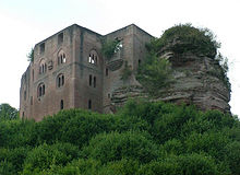
The Franconia-Hesse-Palatinate long distance path (Fernwanderweg Franken-Hessen-Kurpfalz) runs from Aschaffenburg via Speyer and finally through the Palatine Forest, waymarked with a red cross, to Lichtenberg Castle.
Its route through the Forest goes fromd Edenkoben, Naturfreundehaus Sauermilchtälchen, via Taubensuhl and the Eschkopf to Johanniskreuz (to this point it is part of the southern branch of the E 8 European long distance path).
Green and white bars: starting at Wasener Kreuz (west of Hertlingshausen, on the A6 motorway) this route runs through Lambertskreuz, Neidenfels, Esthal, Breitenstein, Forsthaus Heldenstein and St. Martin.
From here the trail passes through Gleiszellen, runs past the Silzer Linde, and the Palatine Forest Club hut of Hirzeck on the French border to St. Germanshof.
Running past the Hardenburg castle, Eckkopf (west of Deidesheim), with a branch to the Stabenberg mountain, and Weinbiet to Neustadt an der Weinstraße, Haßloch, Germersheim before ending in Wörth am Rhein.
White and red bars: another route with this waymark begins in the Krumbachtal valley, runs to Bad Dürkheim, continues along the edge of the Haardt mountains, before passing Heidenlöcher, St. Michael's Chapel near Deidesheim and Gimmeldingen before reaching Neustadt.
It then runs via Thaleischweiler-Fröschen, Burgalben, along the valley of Schwarzbachtal, over the Eschkopf, through Elmstein, Esthal and Mainzertal (on the B 39 federal road), and past the Drachenfels before finishing in Wachenheim.
Red and white bars: beginning in Niederwürzbach the route passed through Erfweiler, Hauenstein, Hermersberger Hof, Eußerthal, Dernbach and Gleisweiler before ending in Böchingen.
Yellow bar: the walk begins near Blieskastel and runs through Contwig, Leimen (Pfalz), Hofstätten, Taubensuhl (Landau Municipal Forest), Eußerthal and Annweiler before reaching Germersheim am Rhein.
Red bar: the third route begins in Neuleiningen, crosses Bad Dürkheim and Wachenheim, continues along the edge of the Haardt to Neustadt an der Weinstraße, St. Martin, Frankweiler and Siebeldingen.
Blue bar: branching off the above long distance path with this marking, it is a short stretch from Drei Buchen ("Three Beeches") to Burrweiler an der Weinstraße.
Red dot: the path from Hertlingshausen (Carlsberg) along the Haardt to the French border runs via Kieskautberg and Rahnfels to Bad Dürkheim, then from Wachenheim via the Heidenlöcher to Deidesheim, and through the Mühltal valley up to the Stabenberg.
From the central station the path runs over the Nollen Saddle up to the Hohe Loog and then on to the Kalmit (673 m), past the ruins of Kropsburg to the Palatine Forest Club hut of Hüttenbrunnen.
As a result, not only are cross-border walks made very easy but it also supports the fact that the Palatinate Forest and the Vosges form a single unit from both a geomorphological and a topographical perspective, and should therefore really only be viewed as two halves of an overarching mountain range on the left bank of the Rhine.