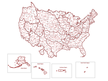
Watershed delineation
It is an important step in many areas of environmental science, engineering, and management, for example to study flooding, aquatic habitat, or water pollution.
Computerized methods for watershed delineation use digital elevation models (DEMs), datasets that represent the height of the Earth's land surface.
Computerized watershed delineation may be done using specialized hydrologic modeling software such as WMS, geographic information system software like ArcGIS or QGIS, or with programming languages like Python or R. Watersheds are a fundamental geographic unit in hydrology, the science concerned with the movement, distribution, and management of water on Earth.
Delineating watersheds may be considered an application of hydrography, the branch of applied sciences which deals with the measurement and description of the physical features of oceans, seas, coastal areas, lakes and rivers.
Watershed delineation continues to be an active area of research, with scientists and programmers developing new algorithms and methods, and making use of increasingly high-resolution data from aerial or satellite remote sensing.
The conventional method of finding a watershed boundary is to draw it by hand on a paper topographic map, or on a transparent overlay.
The watershed area can then be estimated using a planimeter, by overlaying graph paper and counting grid cells, or the result can be digitized for use with mapping software.
"[2] For "manual" watershed delination, one must know how to read and interpret a topographic map, for example to identify ridges, valleys, and the direction of steepest slope.
[1] Instructions for manual watershed delineation can be found in some textbooks in geography or environmental management, in government pamphlets,[4][5] or in online video tutorials.
"[5] Especially for smaller watersheds and when accurate results are important, field reconnaissance may be needed to find features that are not shown on maps.
[9] It is possible to use DEMs in different formats for watershed delineation, such as a Triangular Irregular Network (TIN),[10] or Hexagonal tiling[11] however most contemporary algorithms make use of a regular rectangular grid.
The usual steps for hydrologic conditioning of a DEM are: Additionally, some methods allow for "fencing ridgelines" and burning in flow pathways through lakes.
Some errors stem from incorrectly placing the watershed outlet on the digital river network, or "snapping the pour point.
[19] Watershed delineation tools are a part of several Geographic Information System software packages such as ArcGIS, QGIS, and GRASS GIS.