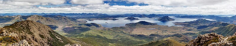
Arthur Range
[5] It is mainly composed of Quartzite and features evidence of past glaciation such as moraines and hanging valleys.
Much of the Arthur Range and the area surrounding land is covered by button grass wet sedgelands.
The climate in the Arthur Range is extremely unstable – weather predictions are virtually useless here, as it is very common to have sun, heavy rain, cloud, strong winds, even snow all in the same day.
In order to reduce mechanical damage to plants, walkers are also encouraged to wade through the middle of muddy track sections.
[6] Access to the Western Arthurs is usually from the Scotts peak dam camp site (43°02′15″S 146°17′52″E / 43.03750°S 146.29778°E / -43.03750; 146.29778) via part of the Port Davey Track.
Among these are: From the north western end, closest to the Port Davey Track:[7] The Eastern Arthurs runs North-South from the end of the Western Arthurs and includes the highest peak of the range, the striking Federation Peak.