Streets and highways of Arlington County, Virginia
This article deals with the streets and highways of Arlington County, Virginia, a suburb of Washington, D.C. in the United States.
Although the streets of Arlington County are not laid out on a grid plan, its local streets follow the Arlington County, Virginia, street-naming system: a system of sequential numbered or alphabetic patterns that are both rational and provide address numbering information.
The group objected to that urban segment due to concerns over air quality, noise and community cohesion changes.
The impasse was eventually broken when the parties agreed on experts to conduct air quality and noise studies for the Virginia Department of Transportation, then known as the Virginia Department of Highways; then, Secretary of Transportation Coleman personally intervened in 1976 with negotiations to reach a compromise by reducing the highway capacity, making I-66 HOV during parts of the day, and including a subway route in I-66's median.
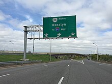
Due to very frequent traffics jams in the four lane section of I-66, many people in the region have advocated widening I-66, although the County Board [1] and many local residents continue to oppose it.
Begun during World War II to serve the Pentagon, Interstate 395 (I-395) (named the Henry G. Shirley Memorial Highway) bisects Arlington as it travels southwest/northeast between the 14th Street Bridge and Alexandria.
It then turns back northeast and runs past the Pentagon to end at the D.C. boundary just before the George Washington Memorial Parkway.
Arlington has two limited-access scenic parkways maintained by the U.S. National Park Service which also serve as major commuter routes.