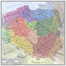
Zawkrze
Zawkrze lies between the Wkra (in the south), Działdówka (in the west), Orzyca and Łydynia (in the east) rivers, and the former border with Prussia in the north.
Currently, Zawkrze is divided between five counties and two voivodeships - Mława, Żuromin, Ciechanów, Nidzica and Działdowo.
It was divided into three counties (Szreńsk, Mława and Niedzbórz), and its boundaries remained unchanged until the Partitions of Poland.
In 1807, Zawkrze became part of the short-lived Polish Duchy of Warsaw, and after its dissolution, from 1815 to 1918, it belonged to Russian-controlled Congress Poland.
Following the joint German-Soviet invasion of Poland, which started World War II in September 1939, the region was occupied by Germany until 1945, and the local population was subjected to persecution.