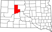
Ziebach County, South Dakota
The present Ziebach County was created by the SD Legislature on February 1, 1911, and was fully organized by April 22.
Previously the area had been used by trappers and in 1907 part was briefly a reservation for Ute Indians displaced from Utah and Wyoming.
Early in the 20th Century cattle were raised in substantial numbers, but when the railroad bypassed the area this industry declined.
[5] The Cheyenne River flows east-northeastward along the southern boundary of Ziebach County.
The terrain is composed of semi-arid rolling hills interrupted by buttes and carved by drainages and gullies, partly devoted to agriculture and cattle.
[6] The terrain slopes to the south and the east; its highest point (except for the isolated Thunder Butte, at 2,733') is near its NW corner at 2,582 ft (787 m) ASL.
It is one of five South Dakota counties that are composed entirely of land that is within the boundaries of Indian reservations.
[9] Ziebach County is part of the Great Plains and is characterized by rolling grasslands and numerous buttes.
Only Ronald Reagan in 1980 and Barack Obama in 2008 have topped sixty percent for either major party in the past six decades.