1883 eruption of Krakatoa
In the years before the 1883 eruption, seismic activity around the Krakatoa volcano was intense, with earthquakes felt as far away as North Australia, one of which, in 1880, damaged a lighthouse.
Earthquakes were felt at Anyer, Banten, and ships began to report large pumice masses to the west in the Indian Ocean.
Waves a few feet in height began battering the coasts of Java and Sumatra at 5:30 pm, and continued throughout the night, which may have been produced by steam explosions.
[4] Ships within 20 km (12 mi) of the volcano reported heavy ash fall, with pieces of hot pumice up to 10 cm (4 in) in diameter landing on their decks.
A large area of the Sunda Strait and places on the Sumatran coast were affected by pyroclastic flows from the volcano.
[6] The sounds of the eruption of the Krakatoa volcano were estimated to be 310 dB SPL, and there are reports that it was heard some 1,300 miles away in the Bay of Bengal.
[12]: 248 It was so powerful that it ruptured the eardrums of sailors on RMS Norham Castle of the Castle Line which was hove to off Sumatra,[12]: 231, 234 and caused a spike of more than 8.5 kilopascals (2.5 inHg) in the pressure gauge attached to a gasometer in the Batavia (correspondent to modern day Jakarta) gasworks 160 km (100 miles) away, sending it off the scale.
Some 80 km (50 mi) away, the low-lying Thousand Islands were submerged under 2 meters (6.6 feet) of seawater, forcing people to climb trees.
Passengers produced this eyewitness account:[13] "Suddenly we saw a gigantic wave of prodigious height advancing toward the seashore with considerable speed.
The wave continued on its journey toward land, and the benumbed crew watched as the sea in a single sweeping motion consumed the town.
[14] Ships as far away as South Africa rocked as tsunamis hit them, and the victims' bodies were found floating in the ocean for months after the event.
[citation needed] This caused several cubic kilometres of material to enter the sea, displacing an equal volume of seawater.
[12] The combination of pyroclastic flows, volcanic ash, and tsunamis associated with the Krakatoa eruptions had disastrous regional consequences.
Some land in Banten, approximately 80 km south, was never repopulated; it reverted to jungle and is now the Ujung Kulon National Park.
[13] There are numerous reports of groups of human skeletons floating across the Indian Ocean on rafts of volcanic pumice and washing up on the east coast of Africa up to a year after the eruption.
"Thousands of corpses of human beings and also carcasses of animals still await burial, and make their presence apparent by the indescribable stench.
They lie in knots and entangled masses impossible to unravel, and often jammed along with coconut stems among all that had served these thousands as dwellings, furniture, farming implements, and adornments for houses and compounds."
Of the northern two-thirds of the island, only a rocky islet named Bootsmansrots ('Bosun's Rock'), a fragment of Danan, was left; Poolsche Hoed had disappeared.
Much of this gained material quickly eroded, but volcanic ash remains a significant part of the geological composition of these islands.
[23] Two nearby sandbanks (called Steers and Calmeyer after the two naval officers who investigated them) were built up into islands by ashfall, but the sea later washed them away.
Seawater on hot volcanic deposits on Steers and Calmeyer had caused steam to rise, which some mistook for a continued eruption.
[27] There was no El Niño during that period as is usual when heavy rain occurs in Southern California,[28] but many scientists doubt that there was a causal relationship.
[29][failed verification] The eruption injected a tremendous amount of sulfur dioxide (SO2) gas high into the stratosphere, which was subsequently transported by high-level winds all over the planet.
British artist William Ascroft made thousands of colour sketches of the red sunsets halfway around the world from Krakatoa in the years after the eruption.
The ash caused "such vivid red sunsets that fire engines were called out in New York, Poughkeepsie, and New Haven to quench the apparent conflagration".
This was because some ash clouds were filled with particles about 1 μm wide – the right size to strongly scatter red light while allowing other colours to pass.
Verbeek's committee's earliest duties were to determine if this was true and verify reports of other volcanoes erupting on Java and Sumatra.
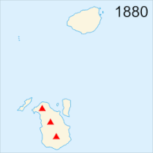
Examinations after 1930 of bathymetric charts made in 1919 show evidence of a bulge indicative of magma near the surface at the site that became Anak Krakatau.
Based on the findings of contemporary investigators, the established hypotheses assume that part of the island subsided before the first explosions on the morning of 27 August.
These findings have led to other hypotheses: A numerical model for a Krakatoa hydrovolcanic explosion and the resulting tsunami was described by Mader & Gittings, in 2006.