1 Line (Sound Transit)
Voters approved Central Link in a 1996 ballot measure and construction began in 2003, after the project was reorganized under a new budget and truncated route in response to higher than expected costs.
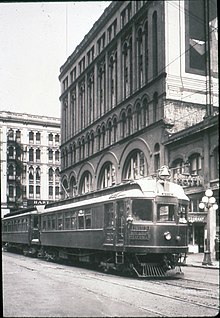
[2][3] Interurban railways to Everett, Tacoma, and the Rainier Valley were established after the turn of the century, giving the region an intercity passenger rail system to feed the streetcar lines.
[3][6] Various proposals for a rapid transit system in Seattle, to replace the streetcar—and later bus—networks, were presented in the 20th century and rejected by city officials or voters due to their cost or other factors.
In 1911, urban planner Virgil Bogue proposed a 41-mile (66 km) system of subway tunnels and elevated railways as the centerpiece to a comprehensive plan for the city, which was rejected by voters.
[8] The Forward Thrust Committee of the late 1960s proposed a 47-mile (76 km) rapid transit system, to connect Downtown Seattle to Ballard, the University District, Lake City, Capitol Hill, Bellevue, and Renton.
[13] Following the failed Forward Thrust initiatives, Metro Transit was created in 1972 to oversee a countywide bus network, and plan for a future rail system.
[16] The PSCOG formally endorsed a light rail plan in 1986, recommending a system be built by 2020, and include a line between Seattle and Sea-Tac Airport,[17] with routing alternatives that served the Rainier Valley.
[23] The agency proposed a 70-mile (110 km) light rail network as the centerpiece of a $6.7 billion transit ballot measure, with a surface line through the Rainier Valley and tunnels between Downtown Seattle, Capitol Hill, and the University District.
[24][25] The ballot measure failed to pass on March 14, 1995,[26] and the light rail line was shortened to 25 miles (40 km), between the University District and Sea-Tac Airport.
[9][33] Planning of the Portage Bay tunnel between Capitol Hill and the University District was suspended due to higher than expected contractor bids, attributed to difficult soil conditions.
[34] Sound Transit adopted the revised budget and schedule in January 2001, including provisions to re-study routing options between Downtown Seattle and the University District, along with a $500 million federal grant agreement to fund the construction of an "initial segment" for the project.
[35][36] The initial segment identified and approved by Sound Transit later that year shortened the line to 14 miles (23 km), between Downtown Seattle and a southern Tukwila station near Sea-Tac Airport.
In November 2002, the King County Superior Court ruled in favor of Sound Transit in a lawsuit filed by light rail opponents, alleging that it lacked the authority to shorten a voter-approved line.
[41] The approval of Tim Eyman's Initiative 776 threatened to repeal motor vehicle excise taxes needed to fund Sound Transit's budget, but was declared unconstitutional in February 2003.
[47][48] Construction of the bridge over the Duwamish River in Tukwila was delayed by the discovery of more than 900 indigenous Coast Salish artifacts in February 2005; work was halted for a six-week excavation and examination by archeologists, including from the Muckleshoot Tribe.
[55][56] The elevated guideway in Tukwila, including crossings over major freeways and the Duwamish River, was completed in 2007 after the installation of 2,457 precast concrete segments and balanced cantilever bridges.
[58] Construction of light rail along Martin Luther King Jr. Way South also resulted in utility lines being moved underground, improved sidewalks, street crossings, and landscaping.
A new escalator contractor was selected to provide preventative maintenance in lieu of a proposed replacement plan; new stairways and connecting passageways were also opened to allow for alternative access.
[85] The third expansion of the 1 Line, a 4.3-mile (6.9 km) northern extension from University of Washington station to the Northgate neighborhood of Seattle, was funded by the Sound Transit 2 ballot measure in 2008 and began construction in 2012.
[91][92] A grade crossing at Royal Brougham Way (adjacent to Stadium station) was replaced in August 2023 due to ground settling that had caused it to sink by 3 inches (7.6 cm).
The line leaves Shoreline elevated into Seattle, passing through provisions made for a future infill station at Northeast 130th Street before descending to a surface alignment.
[53] From SODO station, the track ascends to an elevated guideway traveling east along South Forest Street,[105][111] passing the line's railyard and maintenance facility.
[116] Light rail trains descend from Mount Baker station onto the median of Martin Luther King Jr. Way South, running at-grade with signal priority at 28 street crossings.
The line passes through Tukwila International Boulevard station, home to a 600-stall park and ride facility, and turns south into the median of the Airport Expressway towards SeaTac.
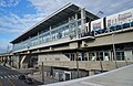
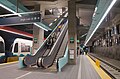
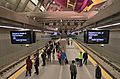
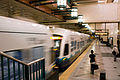
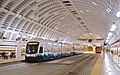
[123]: 6 The line's stations include bus connections,[125]: 16 ticket vending machines, real-time arrivals information signs, public art, and bicycle parking.
[151] A single-day ridership record of 82,361 estimated boardings was set on April 8, 2016,[152] credited to a Seattle Mariners home opener and the Emerald City Comic Con.
[150] The record was surpassed five months later on September 30, estimated at 101,000 riders, due in part to home games for the Washington Huskies football team and Seattle Mariners.
This record was surpassed twice by the end of the month due to several simultaneous weekend events, including Taylor Swift's The Eras Tour concerts at Lumen Field, Mariners games at T-Mobile Park, and the Capitol Hill Block Party.
[190][191] In September 2016, Sound Transit approved a $554 million order to Siemens Mobility for 122 S700[a] "Series 2" light rail vehicles to serve planned extensions to Northgate, Lynnwood, the Eastside, and Federal Way.
[201][209] Two infill stations along the current route of the 1 Line are planned to open in 2031 at South Graham Street in the Rainier Valley and Boeing Access Road in northern Tukwila.

![A group of people stand behind a wide ribbon reading "1 Line to Lynnwood [picture of train] August 30, 2024" with balloons in the background. Two people prepare to cut the ribbon with a pair of oversized scissors.](http://upload.wikimedia.org/wikipedia/commons/thumb/4/49/Lynnwood_Link_ribbon-cutting_ceremony_-_August_30%2C_2024.jpg/220px-Lynnwood_Link_ribbon-cutting_ceremony_-_August_30%2C_2024.jpg)