2011 Pacific typhoon season
[nb 1][1] In early April, the China Meteorological Administration (CMA) predicted that between 24 and 26 tropical storms would develop or move into the basin during the year, which it noted was higher than the previous total of 14.
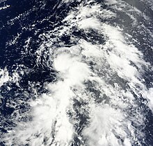
[12] On April 1, the JMA reported that a tropical depression had developed within an area of moderate vertical wind shear about 510 km (315 mi) to the southeast of Ho Chi Minh City in Southern Vietnam.
[24] This intensification prompted the National Weather Service (NWS) in Tiyan, Guam to issue a tropical storm warning for the islands of Agrihan, Pagan and Alamagan.
As the system moved towards the northwest under the influence of a subtropical ridge of high pressure, it rapidly consolidated in an area of light to moderate vertical wind shear.
Although Songda remained offshore, heavy rains within the typhoon's outer bands impacted the Philippines, causing significant flash flooding and landslides.
On July 11, the JTWC started to monitor a tropical disturbance that had developed within a poorly organized monsoon trough about 1,000 kilometers (620 mi) to the northwest of Hagatna, Guam.
The JMA, PAGASA and the JTWC then issued their final advisories on the system later that day as the remnants of Tokage was absorbed into Ma-on, due to the Fujiwhara effect late on July 15.
[51] A few hours later, the JTWC reported that Nock-ten rapidly intensified to a category 1 typhoon and made its landfall over northern Aurora (province) and started weakening.
[92] On August 8, the system started accelerating northwards at a speed of 23 mph (37 km/h) and convection gradually diminished due to colder sea surface temperatures and unfavorable conditions.
[120] On August 23, the system moved into an environment of low wind shear and warm sea surface temperatures prompting the JTWC to issue a TCFA on it.
[138] Over the next two days, the system drifted north and developed a well defined LLCC with organized convective banding, prompting the JMA to upgrade the low-pressure area to a tropical depression.
[143] On September 8, Kulap moved into the east-northeast periphery of the Philippine Area of Responsibility (PAR) prompting the PAGASA to start issuing advisories on the system, naming it Nonoy.
[161] Only six hours later, the storm further weakened and accelerated northeastward at approximately 31 knots (57 km/h; 36 mph) with rapidly dissipating deep convection completely sheared to the northeast of the LLCC.
[168] However, that was not for too long as vigorous convection persisted over the well defined LLCC with tightly curved banding wrapped in, Sonca continued to strengthen gradually and the JTWC reported winds of at least 50 knots (93 km/h; 58 mph) near the center.
[170] Later that day, Sonca developed a large 10 nautical miles (19 km; 12 mi) ragged eye with deep convective banding tightly wrapped into it.
[180] The system rapidly deepened and quickly developed a 30 nautical miles (56 km; 35 mi) ragged eye and mesoscale anticyclone aloft generating an exceptionally excellent all-around outflow.
At that time, it was located near the southern periphery of a deep layered subtropical steering ridge and moved towards the southwest and the winds further dropped to 85 knots (157 km/h; 98 mph) because of land interaction.
[186] On September 29, by the time Nesat managed to re-develop ad 10 nautical miles (19 km; 12 mi) ragged eye, it made landfall over Wenchang in Hainan, China and started weakening again.
The JTWC anticipated the storm to gradually drift over the Gulf of Tonkin and make landfall over Vietnam with a 1-min sustained wind speed of at-least 50 knots (93 km/h; 58 mph).
[188] Early on September 30, Nesat made its final landfall over northern Vietnam with a 1-mim sustained windspeed of 55 knots (102 km/h; 63 mph) and a well-defined, tightly wrapped LLCC, and soon it started weakening.
[191] The residents of Manila had nothing to do but wading through waist-deep floodwaters, dodging branches and flying debris as the typhoon sent surging waves as tall as palm trees over seawalls completely submerging neighborhoods.
Soldiers and police in trucks moved thousands of residents, most importantly the women and the children away from the Baseco shanty after many houses were washed away in the storm surge and floodwaters brought by Nesat.
Though there was a burst of convection at that time, both land interaction and vertical wind shear weakened the system into a tropical depression and the JTWC ceased their advisories.
[200] On September 26, the Japan Meteorological Agency (JMA) started to monitor a weak tropical depression that had developed about 1,260 km (785 mi) to the northwest of Manila in the Philippines.
[208] On October 7, the JTWC started monitoring a tropical disturbance that had developed in an area of low vertical windshear, about 750 km (470 mi) to the south of Hagåtña, Guam.
[211] On November 5, the JTWC started to monitor a tropical disturbance that had developed within an area of low vertical windshear, about 640 km (400 mi) to the east-southeast of Ho Chi Minh City in Vietnam.
During December 3, the JTWC started to monitor a tropical disturbance, that had developed within an area of moderate vertical windshear, about 180 km (110 mi) to the northwest of Bandar Seri Begawan, Brunei.
[213][214][215] Despite being predicted to intensify into a tropical storm after being designated, the depression moved towards the northwest and rapidly deteriorated as it interacted with the cold and dry north-easterlies, as a result the JTWC issued their final warning on the system early on December 5.
After a couple of days drifting southwestwards in the South China Sea, on December 13, the JTWC issued their final advisories on the system as it started to weaken.
[228] On July 16, the JMA reported that a tropical depression had developed about 225 km (140 mi) to the east of Hanoi in northern Vietnam, however it quickly weakened after interacting with land.