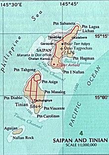
Aguiguan
It is likely that first sighting by Europeans occurred during the Spanish expedition of Ferdinand Magellan, or by its continuation by Gonzalo Gómez de Espinosa being charted as Santo Ángel.
During World War I, Aguijan came under the control of the Empire of Japan and was administered as part of the South Seas Mandate.
[4] Following World War II, Aguijan came under the control of the United States and was administered as part of the Trust Territory of the Pacific Islands.
[5] Due to its sheer steep cliffs, the island has no natural harbor, bay, or beaches, therefore making it difficult for boats to land on.
[5] Approximately 1 kilometer (0.62 mi) off the south-west shore of Aguijan is Naftan Rock, 18 meters (59 ft) in elevation.
[8] From the website https://web.archive.org/web/20110728145947/http://www.uscg83footers.org/new_page_8.htm - Vessel corrected to be the Coast Guard Cutter 83525 Researched by Larry Richter, USCG Ret