Akeld
The village lies on the northern limit of Northumberland National Park and on the foot of the Cheviot Hills massif.
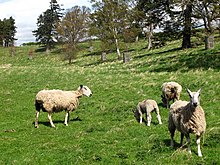
The closure of the railway in the 20th century, combined with declining agricultural employment, has led to a reduction in the village's size and population.
[4] The spelling of Akeld has changed over time, being recorded as Achelda (1169), Hakedla (1176), Akekeld (1246), Akil (1255), Ak(h)ille (1320), Akyld (1428), Akell (1694), and Yakeld (1733).
[3] The earliest evidence of human occupation in Akeld dates back to the Mesolithic period in the form of a microlith – a small flint tool – discovered in the north of the parish.
[6] A Neolithic henge was discovered on flat land to the north of the River Glen and is probably part of a larger collection of monuments found in the Milfield Basin.
A prehistoric settlement, typical of the north Cheviots area, has been discovered at Houseledge East to the south of the village.
A similar Early Bronze Age site was discovered at Houseledge West, consisting of over 12 house circles.
Iron Age hillforts close to Akeld include those on Humbleton Hill and Monday Cleugh, to the south of the village centre.
[5] A promontory fort at Glead's Cleugh, to the south-west of the village centre, was likely to have been in existence by the mid-first millennium BC.
The remains of stone huts at both Harehope Hill and Glead's Cleugh may indicate human habitation, but it is also possible that such buildings may have been used as animal enclosures, market places, trading stations, or community focal points.
[5] However, 2 miles west of Akeld in Yeavering is the renowned site of Ad Grefin, the Anglican palace complex.
This was described in Bede's Ecclesiastical History of the English People as the centre of Bishop Paulinus of Antioch's mission to Bernicia.
[8] During the early Medieval period, the parish of Akeld included the now deserted villages of Ewart and Humbleton.
[9] A bastle – a fortified farmhouse common on the Anglo-Scottish border – was built in 1522 in Akeld which held a garrison of 10 men.
It was subinfeudated to William of Akeld, and after Muschamp's death in 1250 his estate was divided to his granddaughters – the daughters of the Earl of Strathearn.
Sir Chaloner Ogle and Samuel Kettilby (owner of the other three quarters of the manor) came to an agreement to resolve these issues.
In 1828, Archdeacon Singleton wrote about an old graveyard and noted that "there is a tradition of a parochial chapelyard at Akeld, but it seems now to be alienated, and I was told the high road to Wooler passed through it.
Furthermore, during the ownership of Robert of Akeld, the canons of Kirkham obliged him and his heirs to attend the church on all the festivals of Our Lady.
[17] One reason for the increase in population may have been due to the female workers, or bondagers, who were employed to work in the agricultural estates of Scotland and north Northumberland.
[18] Throughout the 20th century, fewer people became employed in agricultural practices due to increased mechanisation and the decline in farming incomes.
Today, Akeld is a civil parish which comprises the former township of Humbledon and part of the Northumberland National Park.
[21] In local government, Akeld is in the Wooler Ward and represented by Northumberland County Councillor Mark George Mather (Conservative).
Akeld Manor is a Grade II listed 18th or early 19th century six-bay farmhouse located in the village centre.
[27] The earliest written reference to the bastle is from 1522 when Lord Dacre proposed to station 10 men there for the defence of the Anglo-Scottish border.
The constituent buildings consist of station offices, a goods shed, a weigh cabin house, and cottages.
[30] The Alnwick–Cornhill line continued in use until the slump in post-World War I passenger services, which in turn led to the closure of Akeld station in 1930.
Akeld became an active train station again during World War II when it was used on the line towards a new Royal Air Force base in Millfield.