Alpine Pass Route
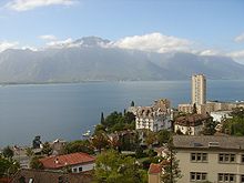
It starts in Sargans in eastern Switzerland, and crosses the heart of country westwards to finish in Montreux on the shore of Lake Geneva.
The total route covers over 325 kilometres (202 mi) and crosses 16 mountain passes, and takes 15 or more walking days to complete.
[1] There are a number of variations on the precise route, but the following stages are fairly standard:[1] The Via Alpina green trail follows the Swiss National Route no.
[2][1] The central portion of the route through the Bernese Oberland is the most spectacular, with many hikers choosing to hike a few passes rather than the whole route in one go.
The excellent transport connections give many possibilities for breaking it up.