Alta Via dei Monti Liguri
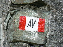
The Alta Via dei Monti Liguri (AV, literally "High Route of the Ligurian Mountains") is a long-distance waymarked hiking trail in the Italian region of Liguria.
In about 440 kilometres (270 mi) and 44 day hikes,[1] it runs through the arc formed by Ligurian Alps and Ligurian Apennines from Ventimiglia (IM, in the westernmost part of the region) to Ceparana (Bolano, SP, on its east side).
The Alta Via has officially born in 1983 from a joint project of Centro Studi Unioncamere Liguri,[2] Club Alpino Italiano and Federazione Italiana Escursionismo.
The trekking path is upheld by the legge regionale (regional law) nr.
5 of 25 January 1993 - Individuazione dell' itinerario escursionistico denominato "Alta Via dei Monti Liguri" e disciplina delle relative attrezzature.