Amstel
[1] It flows from the Aarkanaal and Drecht in Nieuwveen northwards, passing Uithoorn, Amstelveen, and Ouderkerk aan de Amstel, to the IJ in Amsterdam, to which the river gives its name.
[2][3][4] In the 12th century, Amestelle was used for the area or gouw that was closed in by the rivers Amstel and Bullewijk and the bay IJ.
[3][4] Between 1525 and 1990, the water board or hoogheemraadschap of the area through which the river flows was Amstelland (Amstel Land),[7] a name still in use for the region.
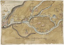
The Amstel was formed around 1050 BC when a freshwater river cut into a tidal channel of the IJ which are now Damrak and Rokin.
[11] The Amstel begins where the canal Aarkanaal and the river Drecht meet, just north of the village Nieuwveen in the province of South Holland.
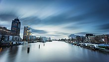
The original course continues with Damrak, after which it passes Stationseiland, an artificial island with Amsterdam Centraal station, and flows into the former bay IJ.