Andrews, Texas
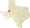
[5] Andrews sits to the far southwest within the Texas Panhandle's plains, about 30 miles east of New Mexico.
Both the city and county were named for Richard Andrews, the first Texan soldier to die in the Texas Revolution.
Waste Control Specialists (WCS), owned by Harold Simmons and headquartered in Dallas, Texas, operates a 14,000-acre (57 km2) site in Andrews County on the border with New Mexico.
The permit allows for disposal of radioactive materials such as uranium, plutonium and thorium from commercial power plants, academic institutions, and medical schools.
[18] For years, a dispute has been simmering concerning to which state these waste sites belong: Texas or New Mexico?
The straight north–south border between the two states was originally defined as the 103rd meridian, but the 1859 survey that was supposed to mark that boundary mistakenly set the border between 2.29 and 3.77 miles too far west of that line, making the waste sites, along with the current towns of Farwell, Texline, and part of Glenrio, appear to be within the State of Texas.
New Mexico's short border with Oklahoma, in contrast, was surveyed on the correct meridian.
The disputed strip, hundreds of miles long, includes parts of valuable oilfields of the Permian Basin.
In 1972, Andrews became the site of the first Kirby Company vacuum cleaner factory outside of the original location in Ohio.
It is often referred to as "Kirby West" to signify the westward expansion of the company, which employs about 200 people.
Voters approved bonds to construct a new $13 million loop around town, which opened in October 2013.
Students are allowed to take the devices home, but must return them at the end of the school year.
[27] The Andrews Business and Technology Center was completed in January 2006, in conjunction with Odessa College and the University of Texas of the Permian Basin.
A $1 million expansion of the campus was completed in 2013 adding space for a registered nurse program.
The park includes a 0.2-mile trail alongside ponds with an overlook deck, benches, and an observation binocular stand.