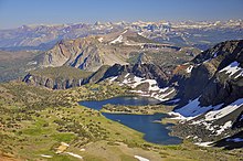
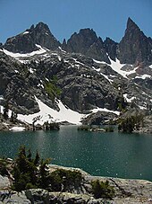
Ansel Adams Wilderness
Immediately to the east of the Ritter Range is the Middle Fork of the San Joaquin River,[3] which contains Devils Postpile, a series of basaltic columns that were revealed and smoothed by glacier action.
[3] To the east of the Middle Fork canyon is the true Sierra Crest, which, at roughly 10,000 feet (3,000 m) of elevation is lower than the Ritter Range.
[3] This relatively low region of the Crest allows winter storms through and cause large amounts of snowfall on Mammoth Mountain, which sits in the gap.
[3] To the west of the Ritter Range lies the canyon of the North Fork of the San Joaquin, a relatively remote and unvisited high-country area.
The southern part of the wilderness contains the 3,000 feet (900 m) deep canyon of the main San Joaquin River, which flows out of the Sierra Nevada to California's Central Valley.