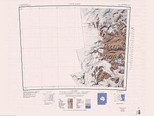
Olympus Range
[1] The Olympus Range extends from the Antarctic Plateau to the Wilson Piedmont Glacier on the west coast of the Ross Sea.
A glacier, 1 nautical mile (1.9 km; 1.2 mi) long, fringing the south and east lower slopes of otherwise ice-free Mount Cerberus.
The glacier was studied and named by Wakefield Dort, United States Antarctic Research Program (USARP) geologist with the University of Kansas Expedition (1965-66), who reported that it is composed throughout of interbedded ice and sand layers.
A northeast-flowing glacier, 1 nautical mile (1.9 km; 1.2 mi) long, on the east side of Eurus Ridge.
Named by NZGB (1998) after Trevor J. H. Chinn of the Institute of Geological and Nuclear Sciences Limited, Christchurch, New Zealand, a glaciologist in McMurdo Dry Valleys for several seasons in the period 1974-93.
A cirque about 0.5 nautical miles (0.93 km; 0.58 mi) wide, in part occupied by a glacier, near the center of the south cliffs of Prentice Plateau, Olympus Range.
Named by US-ACAN (2004) after Jack D. Hawkins, lead PHI helicopter pilot with USAP in eight consecutive field seasons from 1996-97.
A nearly rectangular plateau of about 9 square nautical miles (31 km2; 12 sq mi) at the north side of Wright Upper Glacier[a] and west of Apollo Peak.
Named by US-ACAN (2004) after Michael L. Prentice, Department of Earth Sciences, University of New Hampshire, Durham, NH; in USAP for 15 years from about 1983 including work in McMurdo Dry Valleys.
A mountain 1,917 metres (6,289 ft) high which forms a salient angle in the northeast part of Prentice Plateau.
Named by US-ACAN (2004) after Dennis S. Cassidy, Curator of the Antarctic Marine Geology Research Facility and Core Library, Florida State University, Tallahassee, from 1962-1991.
Named by US-ACAN (2004) after Christopher T. Dean, PHI helicopter pilot with United States Antarctic Project (USAP) in eight consecutive field seasons from 1996-97.
Named by US-ACAN in 1997 after Minze Stuiver, geochemist, Quaternary Research Center, University of Washington, Quaternary specialist in dating Antarctic samples with United States Antarctic Research Program (USARP) from 1969 to the time of naming; authority on the glacial history of the McMurdo Sound region and McMurdo Dry Valleys, the location of this valley (not completed).
Named by US-ACAN (2004) after Thomas R. Parish, Department of Atmospheric Science, University of Wyoming, Laramie, WY, long-term USAP investigator of Antarctic katabatic winds, 1981-97.
A prominent rock spur 2.5 nautical miles (4.6 km; 2.9 mi) long that extends east-southeast from 1,700 metres (5,600 ft) Goldich Crest.
The spur descends to 500 metres (1,600 ft) high at the east extremity where it overhangs Wright Valley and forms the west side of the south entrance to higher Bull Pass.
A peak 1,575 metres (5,167 ft) high surmounting the junction of mountain ridges at the southwest end of Murphy Valley.
Named by US-ACAN (2004) after John H. Wrenn, Department of Geology, Northern Illinois University, DeKalb, IL, a participant in the McMurdo Dry Valleys Drilling Project, 1973-74.
Named by US-ACAN (1997) after Lois M. Jones, geologist, University of Georgia, leader of a 1969-1970 research party in McMurdo Dry Valleys.
Small peak, 1,790 metres (5,870 ft) high, about 3 nautical miles (5.6 km; 3.5 mi) west of Mount Theseus.
Named by US-ACAN (1997) after Clinton L. Baumann, electronic technician, Applied Physics Laboratory, Johns Hopkins University, who was a member of the 1971-72 United States Geological Survey (USGS) field party that established a network of horizontal and vertical control in support of compilation of topographic maps at 1:50,000 scale, of areas of McMurdo Dry Valleys.
Named by US-ACAN (1997) after George W. (Billy) Nottage, topographic engineer, a member of the 1971-72 United States Geological Survey (USGS) field party that established a network of horizontal and vertical control in support of compilation of topographic maps at the scale of 1:50,000 of areas of McMurdo Dry Valleys bounded by 160| and 164|E and 77|15' and 77|45'S.
Named by US-ACAN (1997) after Leroy L. Sanford, topographic engineer, a member of the 1971-72 United States Geological Survey (USGS) field party that established a network of horizontal and vertical control for compilation of eight 1:50,000 scale maps of an area of McMurdo Dry Valleys.
Named by US-ACAN (1997) after Elias E. McClelland, topographic engineer, leader of the 1971-72 United States Geological Survey (USGS) field party that established a network of horizontal and vertical control over a 6,000 square kilometer area of McMurdo Dry Valleys to support compilation of eight topographic maps at 1:50,000 scale.
A pond 0.2 nautical miles (0.37 km; 0.23 mi) long lying in Thomas Valley in eastern Olympus Range.
Named by US-ACAN (1997) after Jean-Claude Thomas, Associate Professor of Geography-Cartography, Catholic University of America, 1967-76, George Mason University, 1976-85; United States Geological Survey (USGS) Cartographer from 1985, specializing in satellite image mapping at various scales, including the 1:25,000-scale color maps of McMurdo Dry Valleys, 1997.
A peak 0.8 nautical miles (1.5 km; 0.92 mi) northeast of Mount Theseus, rising to 1,650 metres (5,410 ft) high in the east part of Olympus Range.
A broad rock ridge, 4.5 nautical miles (8.3 km; 5.2 mi) long, that extends in an east-northeast direction from Mount Helios, Olympus Range, to the vicinity of Lake Brownworth in Wright Valley.
A summit surmounting the east part of the rocky ridge between Greenwood Valley and Wright Lower Glacier.
Discovered by the BrNAE, 1901-04, under Scott, and named after Lieutenant Gerald S. Doorly, RN, of the Morning, relief ship to the expedition.