Attack on Looking Glass camp
When the Americans arrived, Looking Glass told them they were living in peace and asked them to leave, but a shot fired by one of the civilian volunteers accompanying the soldiers precipitated the confrontation.
In May 1877, after several incidents between settlers and the Nez-Percés, General Oliver Otis Howard, head of the Columbia Department, gave the rebels 30 days to return to the reservation.
[4] Over the next two days, some sixteen Nez Perces, carried away by the fury of war, launched new raids on the surrounding villages, killing 18 whites and severely wounding 6 others.
[4] The groups of Chief Joseph, Toohoolhoolzote and White Bird gathered not far from the mouth of Cottonwood Creek,[6] then planned to settle near Looking Glass's camp.
At dawn on June 17, American troops entered White Bird Canyon, while the Nez Perce stood ready to confront them.
The ensuing battle was a heavy defeat for the American army; Perry lost 34 of his men, while the Nez Perce suffered no casualties.
[9] Certain that the Americans would be back in force, the Amerindians preferred to retreat to the other side of the Salmon River, even if it meant re-crossing at another point if the soldiers decided to pursue them.
[13] Until then, Howard had always been skeptical that Looking Glass could play a role in the conflict, and was satisfied that he had chosen to stay on his land,[14] but this latest information changed his mind and he ordered Captain Stephen Girard Whipple to "arrest Indian Chief Looking Glass, and all other Indians who may be encamped with or near him, between the arms of the Clearwater, and imprison them at Mount Idaho, turning them over to the volunteer organization of that place for safe keeping".
[11] The soldiers sent by General Howard formed Companies E and L of the 1st Cavalry Regiment, totaling 67 men,[11] plus twenty civilian volunteers in Mount Idaho were led by Darius B.
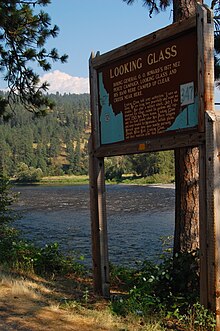
The Looking Glass camp was situated on the banks of Clear Creek, not far from its confluence with the Central Branch of the Clearwater, near the present-day town of Kooskia and some thirty kilometers northeast of Mount Idaho.
[16] Alerted by the arrival of the soldiers, Looking Glass, who was having breakfast in his tepee with several of his men, sent Peopeo Tholekt to tell them that they were living here in peace, and asked them to leave them alone.
[21] After the interpreter had convinced him that it wasn't Looking Glass, he asked Peopeo Tholekt to inform his boss so that he could come and negotiate in person.
[24] This time, one of the officers,[note 3] accompanied by two or three men and the interpreter, returned to the camp with Peopeo Tholekt and Kalowet and asked to see Looking Glass.
[22] As they arrived at the white flag, someone – probably one of the volunteers – fired a shot in the direction of the camp and wounded an Amerindian in the hip, putting an end to all attempts at negotiation.
[29] Due to the late arrival at the camp and the loss of the element of surprise, the main objective of capturing Looking Glass and his group was not achieved.
[22] This not only strengthened the ranks of the Nez-Percés fighters, but also gave them, in Looking Glass, a recognized and respected military leader who was familiar with the Montana lands to which the Amerindians would later head.