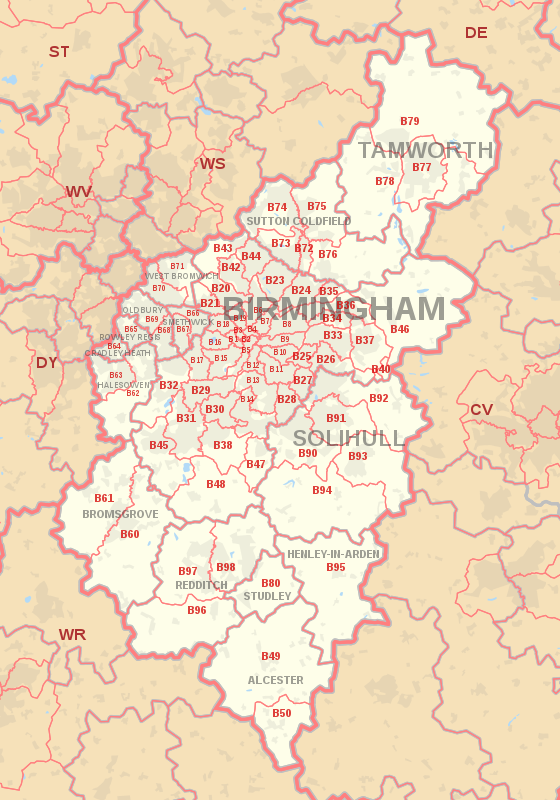
B postcode area
The B postcode area, also known as the Birmingham postcode area,[2] is a group of 79 postcode districts in central England, within 15 post towns.
These cover the central portion of the West Midlands (including Birmingham, West Bromwich, Sutton Coldfield, Smethwick, Solihull, Halesowen, Cradley Heath, Oldbury and Rowley Regis), plus northeast Worcestershire (including Bromsgrove and Redditch), north and west Warwickshire (including Alcester, Studley and Henley-in-Arden), and part of southeast Staffordshire (including Tamworth) and a very small part of Leicestershire.
It is the most populated postcode area in the United Kingdom, with a population of over 1.9 million.
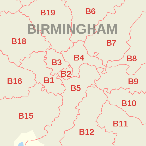
The approximate coverage of the postcode districts: B1-B48: BIRMINGHAM Post Town B49-61; B80-B98: South and East of the BIRMINGHAM Post Town B62-B71: The Black Country B72-B79: North of the BIRMINGHAM Post Town Before the introduction of postcodes in the 1960s, Birmingham along with other major cities were divided into numbered postal districts.
With a few exceptions these were directly incorporated into the outcode (the first part of the postcode).