Bannaventa
Bannaventa straddles the boundaries of Norton and Whilton, Northamptonshire, England, villages highly clustered 1 kilometre (0.62 mi) and double that away, respectively.
Bannaventa is derived from Brittonic *bannā "peak, hill" (as in Modern Welsh ban, "top, tip, point, summit, crest, peak, beacon, height, pinnacle, turret, hill, mountain, bare hill")[5] and *wentā, of obscure origin, but perhaps "place of sacrifice"[6][7] or simply "place, field" (as in Welsh cadwent "battlefield")[8][9] Brief mention of the settlement is thrice found in Emperor Antoninus Pius’s Itinerarium, Iter Britanniarum (The Road Routes of Antoninus Augustus):[10] The sites of these names are as follows: This emperor died in 161 CE.
Bannaventa was a staging post for Romano-Celtic travellers and would have operated along the lines of the coaching towns of a later period along Watling Street.
[14] There have been many archaeological finds across the site including the discovery of a skeleton and numerous cremations in a Roman burial ground a little south of the boundary of the fortifications.
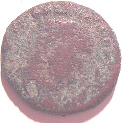
Other discoveries include Constantinian coins, some foundations, stonework, and pottery; most were found in the early 18th century and they led to the definitive location of the town.
[16] The settlement was enclosed by an imperfect square (distended to the south-east) with broad rounded corners, bounded by a series of three sets of banks and ditches.