Barelas
It consists of the triangular area bounded by Coal Avenue, the BNSF railroad tracks, and the Rio Grande.
Although it was long one of Albuquerque's most economically distressed areas, Barelas has seen significant development since the opening of the National Hispanic Cultural Center in 2000 and may be starting to experience gentrification.
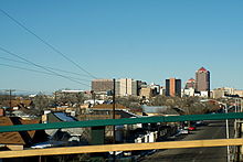
The neighborhood occupies a roughly triangular region between the Rio Grande and the BNSF railroad tracks south of Coal Avenue, which forms the boundary with Downtown.
[6] The area now known as Barelas was originally the site of an important river crossing on El Camino Real de Tierra Adentro, the main Spanish trade route through New Mexico.
[7] A settlement was formally established there (on paper at least) by colonial governor Diego de Peñalosa in 1662, though it remained largely unpopulated until the 19th century.
On that occasion, Union troops in Barelas exchanged long-range artillery fire with a Confederate position east of Albuquerque for several hours, with no casualties.
In order to keep the route as straight as possible, however, the railroad planners chose to build the Albuquerque depot and some 1.5 miles (2.4 km) east of the actual town.
[10] Fueled by the presence of the massive Santa Fe Railway Shops, Albuquerque's largest employer at the time, Barelas underwent a rapid transformation from quiet farming village to busy blue-collar neighborhood.
The road was soon lined with filling stations, garages, and cafes catering to the steady stream of travelers passing through Barelas.
[12] The new east-west route was 90 miles (140 km) shorter, but the rerouting of the highway from 4th Street to Central Avenue bypassed Barelas entirely.
A major turning point came in 2000 with the opening of the National Hispanic Cultural Center, a $50 million project that brought visitors and capital back into the neighborhood.