Bargara, Queensland
Download coordinates as: Bargara /bəˈɡɑːrə/[2] is a coastal town and suburb in the Bundaberg Region, Queensland, Australia.
Bargara is considered to be a satellite suburb of Bundaberg,[citation needed] with only sugar cane fields separating the two centres.
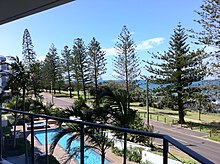
The Esplanade runs along the Bargara Beach foreshore, and is lined with several modern holiday homes and units.
The Mon Repos turtle rookery is located just north of Bargara.
A wall in the reserve dating back to the very early days of settlement was constructed using Kanaka labour and rocks taken from the nearby sugarcane fields.
Although officially separate towns, Nielson Park and Bargara are effectively a continuous urban area,[6] and Nielson Park is generally regarded just as a picnic ground and beach area of Bargara.
[18] In February 2012, the Bargara Lions Club Park for the Disabled was renamed the Bill Fritz Park for the Disabled in honour of the late Bill Fritz, who was a long-time active member of the Lions Club and other community groups.
[19] Bargara has grown significantly over the last decade, becoming a popular tourist and retirement destination.[when?
][citation needed] On Australia Day 2013, Bargara was struck by a tornado spawned by ex-Tropical Cyclone Oswald.
One more small shopping complex exists at the entrance to the Carlyle Gardens Retirement Village on Woongarra Scenic Drive.
Despite its name, Bargara State School is in the neighbouring locality of Mon Repos to the north-west.