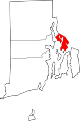
Barrington, Rhode Island
Barrington is a suburban, residential town in Bristol County, Rhode Island, United States, approximately 7 miles (11 km) southeast of Providence.
It was a sparsely developed, agricultural community until the arrival of brickmaking companies in the 1850s, which employed large numbers of French-Canadians and Italians.
Barrington was originally occupied by the Wampanoag Indians, whose territory spread from Narragansett Bay to Cape Cod.
Many farmers planted fruit trees and some developed large orchards, as apple cider was an important commodity for trade.
Farming significantly affected the landscape, separating large grassland fields with fencing and stone walls.
But rapid population increases shifted influence northward, where abundant marshland and fertile soil allowed farmers to establish large, successful farms.
[6]: 13 The north continued to develop due to a combination of commercial establishments (mainly taverns and inns) and farmhouses near the relocated church.
[6]: 3 The railroad led to the creation of several manufacturing industries in West Barrington, such as O'Bannon Mill and Rhode Island Laceworks (which provided commercial firefighting services for the town).
The 1938 New England hurricane caused considerable damage to homes along the shoreline and pleasure craft, and railroad service was discontinued shortly afterward.
[4] Commercial establishments on County Road further reduced the need for outside travel and significantly altered the existing town landscape.
[6]: 3 In the 1990s, the American Civil Liberties Union (ACLU) sued the town for its Christmas display, which featured a crèche.
Similarly, a lawsuit filed in 1996 by the ACLU regarding the town's decision to plow church parking lots for free was not contested.
During the 2016 Republican presidential preference primaries, Barrington was the only town in Rhode Island to be won by former Governor John Kasich of Ohio.
A rare, well-preserved example of a vernacular house plan, it exemplifies architecture from Barrington's agricultural era.
[21][22] Rhode Island Country Club was constructed by Donald Ross in 1911, and since 1999 has hosted the CVS Charity Classic annually.
The T-shaped Elizabethan-Revival Peck School, which features a stairway to access its main entrance, was repurposed as the Barrington Public Library in the 1970s.
[27] Belton Court, built for Frederick Peck, a businessman and Rhode Island politician, was the site of two colleges before being auctioned to a Massachusetts investor who intends to repurpose it as elderly housing.
[30] Situated 7 miles (11 km) southeast of Providence, it consists of two peninsulas divided by the Barrington and Warren rivers.
The shoreline of the western peninsula, Phebe's Neck or Popanomscut, is marked by many coves and indentations, making a sharp bend at Nayatt Point.
This plain, composed mostly of layers of clay, gravel, sand, and silt soils, was formed by a melting glacier towards the end of the last ice age.
A few extremes in elevation, such as Nayatt Point, Primrose and Prince's Hill, rise to heights of fifty feet.
Clay deposited by the glacier near Brickyard Pond is exposed to tidewater at Mouscochuck Creek, which was used as a canal for brickmaking operations.