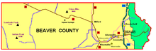
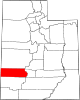
Beaver County, Utah
Explorers of European descent first visited present-day Beaver County in the 1776 Domínguez-Escalante Expedition.
[5] The county boundary as delineated by that act included areas in present-day Colorado and Nevada.
However, its west area was reduced by the creation of the Nevada Territory on July 14, 1862 (this adjustment was altered on May 5, 1866, by the action of the US Congress, effectively ceding all Beaver County area west of 114 degrees longitude to Nevada counties).
The west part of the county consists of low rolling hills punctuated by isolated mountains.
[8] The terrain slopes to the west and north; its highest point is a mountain crest on its east border, at 12,011 ft (3,661 m) ASL.
[10] The Tushar Mountains lies on the eastern boundary of the county, reaching to 12,000 feet (3,700 m) in elevation and providing water for the farming communities of Beaver and Manderfield.
To the west, barren desert valleys typify the scenery, separated by mountains lightly forested with junipers.
Jimmy Carter in 1976 was the last Democrat to even come within ten points of winning Beaver County.