Bedford Shale
South of Columbus, the color fades to reddish-brown and exists only as a bed a few feet thick between bluish or bluish-gray Bedford Shale.
Siltstone beds increase in number and thickness in the upper part of the Bedford shale south of Columbus.
[17] The Bedford Shale appears gray or greenish-gray in Kentucky, and contains sparse to abundant thin beds of siltstone, calcareous concretions, and nodules of pyrite.
[6] Outcrops of the Bedford shale may be found throughout Cuyahoga, Lake, and Geauga counties in cliffs beneath the Berea sandstone.
[18] It is about 100 feet (30 m) thick in Letcher and Pike counties,[36] which were closest to the Famennian deltas being deposited from the east and southeast.
[39] In Kentucky, a transition zone ranging from a few inches to 4.2 feet (1.3 m) in thickness occasionally appears as the basal member of the Bedford Shale.
Its edge cannot be readily determined, as the Bedford's gray shale and interbedded siltstones overlay extremely similar Early Famennian rocks.
[10] It is difficult to impossible to visually determine the boundary with the Chagrin Shale due to its lithologic similarity with the Bedford.
[50] Pre-Berea and Berean erosion eroded significant portions of the red Bedford Shale in northern Ohio.
Along Ohio's eastern border, in Columbiana, Mahoning, and Trumbull counties, erosion has almost completely removed the Bedford Shale.
The upper part of Bedford in this state is silty and sandy,[24] making the boundary between it and the Berea sandstone nearly impossible to identify visually.
The boundary between the two becomes increasingly difficult to identify as one proceeds west, as the Bedford merges laterally into the upper 97 feet (30 m) of the Ellsworth Shale.
These include brachiopods like Lingula, Orbiculoidea, and the large Syringothyris bedfordensis; molluscs, particularly bivalves;[55] and Devonian fish.
[45] South of Ross County, most of the siltstones in the Bedford Shale show fucoids (casts of Fucales, a common littoral seaweed).
[45] Although there have been conflicting reports in the past, the most recent evidence is that the rock was laid down very late in the Famennian stage of the Devonian period.
[68][g] In their 1991 review of the literature, geologists Raymond C. Gutschick and Charles A. Sandberg point out that the Bedford Shale is correctly assigned to the upper Devonian.
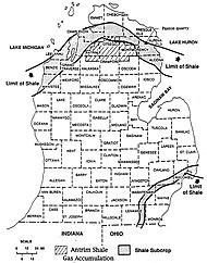
[16] During the Famennian stage of the late Devonian period, the Rheic Ocean covered much of what is now Kentucky, Michigan, and Ohio in the United States.
Stronger currents stirred up the mud, which mixed with the coarse sediment and became the basal part of the Bedford Shale.
[23][i] The ancient Ontario River probably entered the Ohio Bay about Lorain County,[80] depositing red sediment which originated in the eastern part of the Canadian Shield.
[23] In time, the Red Bedford Delta extended about 210 miles (340 km) south into the Ohio Bay,[78] nearly dividing it.
[78] Oscillation ripple marks in the siltstone of the Bedford Shale's gray basal part shows that this sediment was deposited under water.
There is also a well-documented system of about 100 miles (160 km) of ancient braided and meandering water channels in Ashland, Holmes, and Knox counties, indicating where the distributary network of the river sought to reach the sea.
It not only rose over the next several million years, it accreted sediment to it—perhaps extending almost to the northern shore of the Ohio Bay.
[86] A number of sandbars, collectively known as the Channel Sands,[87] existed on either side of what later became the Red Bedford Delta.
[88] Two large siltstone lentils were created during the deposition of the Bedford Shale, the northern Sagamore and the southern Euclid.
[17][14] Relatively coarse clastic material[14] eroded from the Canadian Shield[17] was carried by the ancient Ontario River System south into the Michigan Basin of the Rheic Ocean.
[33] The shale exhibits cross-bedding and erosional channels filled with Berea Sandstone, both of which indicate that the Rheic Sea was shallow.
[93] Three ancient rivers—the Gay-Fink, the Cabin Creek, and the Virginia-Carolina—probably deposited most of the sediment,[80] which consisted of detrital rock and organic matter from the Acadian Mountains flowing westward and southward[33] into the shallow sea covering the Appalachian Basin.
[94] Evidence for a westerly and southwesterly flow of water comes from channels eroded in the shale and filled with sandstone.
Ripple marks in the Bedford Shale in Kentucky form in a northwest–southeast line, indicating a steady wind coming from the northeast.