Beinn Achaladair
Beinn Achaladair is a Scottish mountain situated six kilometres north east of the hamlet of Bridge of Orchy.
[2] Beinn Achaladair reaches a height of 1,038 metres (3,406 ft) and is classed as a Munro and a Marilyn, geographically it is part of the southern highlands but it stands at their northern extremity and displays many of the characteristics of the rockier peaks to the north.
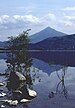
It is believed that the mountain takes its name from the settlement of Achallader at the foot of the northern slopes and translates from the Gaelic as “Field of hard water” which referred to the area around Loch Tulla which often flooded and froze in the past.
Beinn Achaladair has two corries on its slopes, to the east of the summit ridge is Coire nan Clach which contains eight very small lochans in its upper recesses.
[7] The farmer at Achallader kindly allows walkers to park in a field next to farm and they can show their appreciation by leaving money in an honesty box.