Meall Glas
It stands on the northern border of the Loch Lomond and the Trossachs National Park, 8.5 kilometres north east of Crianlarich.
Broad slopes to the east descend to the Lairig a’ Churain (609 metres) which connects to the adjacent Munro of Sgiath Chuil.
The south side of the mountain has a broad shelf at a height of around 450 metres, the result of lateral erosion by glaciers in the Ice Age.
The route starts at Auchessan (grid reference NN446276) on the A85 road and goes north across moorland to reach the summit ridge just to the east of the highest point.
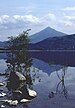
The mountain has a considerable prominence of 554 metres and is a good viewpoint, with the Mamlorn peaks around the head of Glen Lochay and the Crianlarich hills to the south west looking especially fine.