Birbhum district
Birbhum district (Bengali pronunciation: [biːrbʰuːm]) is an administrative unit in the Indian state of West Bengal.
Often called "the land of red soil",[6] Birbhum is noted for its topography and its cultural heritage which is somewhat different from the other districts in West Bengal.
[13][14] Another theory says that the district bears the name of Bagdi king Bir Malla, who ruled in the area from 1501 to 1554 CE.
[13][14] Situated between 23° 32' 30" (right above the tropic of cancer) and 24° 35' 0" north latitude and 87° 5' 25" and 88° 1' 40" east longitudes, and about 4,545 square kilometres (1,755 sq mi) in area, this district is triangular.
[5][11][13] Geographically, this area lies at the northeastern end of the Chota Nagpur Plateau, as it slopes down and merges with the alluvial plains of the Ganges.
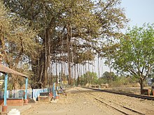
In the district there is only hilly area of natural rock formation situated near Dubrajpur town called Mama Bhagne Pahar (Hills).
The comparatively more fertile eastern portion, constituting the northeastern Rarh region, merges with the Gangetic plain.
[19] According to the old Jain book Acaranga Sutra, the last (24th) great Tirthankara Mahavira had wandered through this land, referred to as the "pathless country of Ladha in Vajjabhumi and Subbhabhumi (probably Suhma)" in the fifth century BCE.
[21] Based on Divyabdan, a Buddhist text, Dr. Atul Sur has inferred that Gautam Buddha probably traversed this area to go to Pundravardhana and Samatata.
[5] The region was ruled by Muslims in the 13th century CE, although their control over the western parts of the district appears to have been minimal, with true power resting in the hands of the local Hindu chiefs, known as the Bir Rajas (Bagdi Malla dynasty).
Minhaj-i-Siraj, the author of the Tabaqat-i-Nasiri, mentions Lakhnur as the thanah (headquarters) of the Rarh wing of the Muslim rule and an important frontier post.
[25] The administrative unit called Birbhum was first formed in 1787 under the British East India Company, as "District Beerbhoom".
Until the 1857 Sepoy Mutiny, the Santhal Parganas was part of Birbhum; the district thus sprawled up to Deoghar in the west.
[16] Major crops produced in the district include rice, legumes, wheat, corn (maize), potatoes and sugar cane.
Canada Dam on the Mayurakshi river at Massanjore lies close to the border of Birbhum and the Dumka district in Jharkhand.
Some of the notable forms of cottage industries of Birbhum include textile—especially cotton and locally harvested tussar silk, jute works, batik, kantha stitch, macramé (weaving by knotting threads), leather, pottery and terracotta, solapith, woodcarving, bamboo and cane craft, metal works and tribal crafts.
As the business epicenter of Birbhum, Sainthia was home to a prominent coconut oil manufacturer established by the Chandra family.
'Lion (সিংহ) Marka' (Lion Brand) coconut oil, which was manufactured and processed in a factory located in main Sainthia.
This iconic brand not only gained statewide and national recognition but also became a symbol of the Sainthia’s industrial prowess, significantly contributing to its economic growth.
Today plenty of large, semi-large scale businesses run in this city, credit to its well connected logistics and rail network.
[50] People of Birbhum patronise folk entertainment programmes such as jatra, kavigan, raibenshe and alkap.
Birbhum has many old temples, such as the ones at Jaydev Kenduli, Surul and Nanoor, with delicate decorative tiles made of terra cotta (burnt clay).
[54] The eastern area of Birbhum is a part of the rice plains of West Bengal, and the vegetation includes usual characteristics of rice fields in Bengal, such as species of Aponogeton, Utricularia, Drosera, Philcoxia, Scrophulariaceae and similar aquatic or palustrine genera.
[13][55] In the drier western region of the district, the characteristic shrubs and herbs include species of Wendlandia, Convolvulaceae, Stipa, Tragus, Spermacoce, Ziziphus, Capparis and similar plants that grows on laterite soil.
[55] Other than feral dogs and domestic cattle, the most frequently encountered non-human mammal is the hanuman, a long tailed grey langur prevalent in the Gangetic plain.
[55] Sometimes during the season when mahua trees bloom, wild Asiatic elephants from Jharkhand come in trampling crops and threatening life and property.
[55] Birds of Birbhum include a mix of hilly and plain-land dwelling species like partridge, pigeon, green pigeon, water fowls, doyel, Indian robin, drongo, hawk, cuckoo, koel, sunbird, Indian roller, parrot, babbler, and some migratory birds.
[56] Economically important trees are planted here and blackbucks, spotted deer, jackals, foxes and a variety of water birds live in its 2 km2 (0.8 sq mi).
While it is feared that Birbhum may not be able to fulfill the national objective of sending all children in the age group 6–14 years to school by 2010, efforts are on in that direction.
A major cricket event named as: Dream Gold Cup is organised in Labpur every year in the month of January.