Blackwater River (Virginia)
In contrast, some of the region's wetlands are not streams, such as the bog-like pocosins found on the higher land between swamp-stream drainages.
The Blackwater River Preserve protects one of the oldest bald cypress and tupelo swamp forests in the South, with trees up to 800 years old.
The largest known water tupelo in the United States, according to the National Register of Big Trees, is in Isle of Wight County.
Another stand of old-growth bald cypress and tupelo forest, known as Dendron Swamp, was recently designated a Natural Area Preserve by the Virginia Department of Conservation of Recreation.
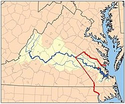
The river then turns south into Southampton County where several boat ramps are accessible for anglers, hunters and boaters alike.
On any one trip you can see whitetail deer, numerous waterfowl, raccoons, squirrels and many unique reptile and amphibian species, not to mention a healthy fish population swimming under the water's surface.
In 1646, after two years of war between the Virginia colony and the Powhatan confederation, a peace treaty was agreed to by the leaders of the two sides (Governor William Berkeley and Chief Necotowance).
Native Americans were only allowed to cross this line at the newly built Fort Henry on the Appomattox, where Petersburg now is, and they had to display a special badge, without which they could be killed on the spot, or after 1662, arrested.
By the late 17th century, some settlers from Virginia were crossing the Blackwater-Ft. Henry-Monacan town boundary, and settling in territory of Indian tribes such as the Appomattoc and the Nottoway.
According to a petition by the colonial government of Virginia made to the King, dated May 1, 1688, the Tributary Indians, who still legally owned the land west of the line, allegedly asked for settlers to move into their territory.
The reason for the request was said to be fear of invasion by larger, non-Tributary tribes, in light of their own dwindling numbers, besides that "Such large Tracts of Land are of noe benefit nor use unto them".
[6] However, King William and Queen Mary wanted the moratorium on patents extended, and in 1691, another order was given demanding all settlers south of the river to return north.
Migration and settlement patterns thus tended to follow the rivers, most of which flowed from the west and emptied into Chesapeake Bay.
As early as 1713 a place called South Quay six and a half miles downriver from Franklin was becoming an important trade port.
The South Quay venture eventually also became a shipyard and built two ships, the Caswell and the Washington, that helped defend the coast from the British fleet in 1777/78.
During the American Civil War, the Blackwater River was for a time the dividing line between Union-occupied territory and Confederate Virginia.
The boundary was not well defended, allowing thousands of "contrabands" (as the slaves were called during the war) the chance to flee east out of Southampton County, across the Blackwater River and into freedom.
Because the Blackwater River drains a large area of southern Virginia east of the Atlantic Seaboard Fall Line, when heavy rainfall occurs throughout the area, severe flooding occasionally occurs at several points as the large volume of water flows downstream.
Unlike the marshy areas upstream, at these points the river's channel is limited, and flood stages can be reached very quickly.
This occurred during Hurricane Floyd in 1999, and again in October 2006, after an unnamed Nor'-Easter storm dumped 10 inches (25 cm) of rain on the region.