Hurricane Floyd
Aided by favorable outflow, the system organized further into Tropical Depression Eight late on September 7, located about 1,000 mi (1,600 km) east of the Lesser Antilles.
With a strong ridge of high pressure to its north, the nascent tropical depression moved to the west-northwest, where environmental conditions favored continued strengthening,[2] including progressively warmer water temperatures.
[7] On September 11, Hurricane Floyd moved through the upper-level trough, which, in conjunction with an anticyclone over the eastern Caribbean, disrupted the outflow and caused the winds to weaken briefly.
[8] Around this time, tropical cyclone forecast models suggested an eventual landfall in the Southeastern United States from Palm Beach, Florida to South Carolina.
[9] At its peak, tropical storm-force winds spanned a diameter of 580 mi (930 km), making Floyd one of the largest Atlantic hurricanes of its intensity ever recorded.
[2] While approaching the southeastern United States, a strong mid- to upper-level trough eroded the western portion of the high-pressure ridge, which had been steering Floyd for several days.
At around 06:30 UTC on September 16, Hurricane Floyd made landfall in Cape Fear, North Carolina with winds of 105 mph (169 km/h), a Category 2.
Continuing northeastward along a cold front, Floyd moved through eastern North Carolina and southeastern Virginia, weakening to tropical storm status by late on September 16.
The storm gradually lost its tropical characteristics as it quickly moved through the Delmarva Peninsula, eastern New Jersey, Long Island, and New England.
[20][21][22] In Atlantic Canada, the Canadian Hurricane Centre issued 14 warnings related to Floyd, generating significant media interest.
[27] Numerous restaurants, hotels, shops, and homes were devastated, severely limiting in the recovery period tourism on which many rely for economic well-being.
When Hurricane Floyd moved across the state in early September, it produced torrential rainfall, amounting to a maximum of 19.06 in (484 mm) in Wilmington.
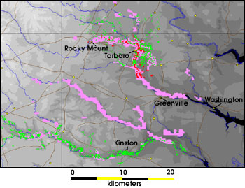
[36] Due to the heavy flooding in downtown Greenville, the East Carolina Pirates were forced to relocate their football game against #9 Miami to N.C. State's Carter–Finley Stadium in Raleigh, where they beat the Hurricanes 27–23.
As quoted by North Carolina Secretary of Health and Human Services H. David Bruton, "Nothing since the Civil War has been as destructive to families here.
[2] While Floyd moved through southeastern Virginia, it was still at hurricane status, producing winds strong enough to knock down hundreds of trees and power lines.
[40] In addition to the heavy rainfall, tides in Norfolk were 3.9 ft (1.2 m) above normal, resulting moderate to locally severe coastal flooding.
The storm knocked down trees and dropped heavy rainfall, causing a shop on New York Avenue NW to close after the roof collapsed.
High tides, 2 to 3 ft (0.61 to 0.91 m) above normal, affected coastal areas of St. Mary's, Calvert, Harford, and Anne Arundel counties, with 5 houses destroyed and 23 severely damaged.
[2][21] As Floyd continued up the coast, it dropped heavy rainfall in New Jersey, reaching 14.13 in (359 mm) in Little Falls; this was the highest statewide rain from a tropical cyclone since 1950.
[22][49] The Rochelle Park, New Jersey hub of Electronic Data Systems was inundated by the nearby Saddle River, disrupting service to as many as 8,000 ATMs across the United States.
Many creeks swelled to record levels, in some cases over double their estimated flood stage, which left motorists in need of rescue, including a bus with 11 students in Buckingham Township.
[59] The strong winds, combined with saturated ground from the rainfall, brought down trees in widespread areas of the Hudson Valley and Capital District.
In a narrow swath in the Wolf Pond Valley of Warren County, where wind gusts are estimated to have reached 80 mph (130 km/h), hundreds of trees were blown down.
[60] Throughout Orange, Putnam, Rockland, and Westchester counties, initial cost estimates were $14.6 million, although that figure represents only a portion of the actual monetary damage.
Wind gusts exceeding 50 mph (80 km/h), combined with the saturated ground, brought down many trees and triggered severe power outages in the area.
The Confederation Bridge connecting Prince Edward Island to the mainland shut down during the storm due to 72 miles per hour (116 km/h) winds.
In the immediate aftermath of the storm, freshwater runoff, sediment, and decomposing organic matter caused salinity and oxygen levels in Pamlico Sound and its tributary rivers to drop to nearly zero.
Strangely, however, the year's shrimp and crab harvests were extremely prosperous; one possible explanation is that runoff from Hurricane Dennis caused marine animals to begin migrating to saltier waters, so they were less vulnerable to Floyd's ill effects.
[83] Ronnie Kennedy, Duplin County director for environmental health, said that of 310 private wells he had tested for contamination since the storm, 9 percent, or three times the average across eastern North Carolina, had faecal coliform bacteria.
[84] Due to the high impact, extensive damage, and loss of life from the hurricane, the name Floyd was retired by the World Meteorological Organization in the spring of 2000, and it will never again be used for another north Atlantic tropical cyclone.

Tropical storm (39–73 mph, 63–118 km/h)
Category 1 (74–95 mph, 119–153 km/h)
Category 2 (96–110 mph, 154–177 km/h)
Category 3 (111–129 mph, 178–208 km/h)
Category 4 (130–156 mph, 209–251 km/h)
Category 5 (≥157 mph, ≥252 km/h)
Unknown