Bridgeport, Washington
The area that is now Bridgeport was settled in the late 19th century and originally named Westfield.
Some of the earliest settlers in the area were Chinese miners extracting gold from the banks of the Columbia River.
[5] According to the United States Census Bureau, the city has a total area of 1.05 square miles (2.72 km2), all of it land.
[6] Bridgeport has over 1½ miles of Columbia River Waterfront that is within the City Limits.
Bridgeport is currently experiencing expansion and development of waterfront properties with a re-newed energy.
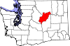
Bridgeport is located directly adjacent to the Okanogan County border connected by the north-south Rufus Woods Lake.
Its nearby recreational tourism destination is situated in Okanogan County north of the city.
Both cities set this record during the June 2015 northwest heat wave.
17.1% of all households were made up of individuals, and 5.9% had someone living alone who was 65 years of age or older.