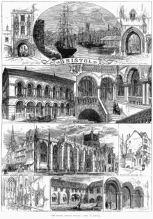
Bristol
The city's modern economy is built on the creative media, electronics and aerospace industries; the city-centre docks have been redeveloped as cultural and heritage centres.
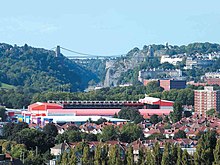
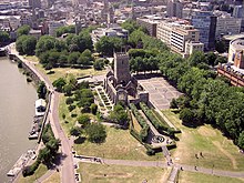
There are a variety of artistic and sporting organisations and venues including the Royal West of England Academy, the Arnolfini, Ashton Gate and the Memorial Ground (Bristol).
[12] Archaeological finds, including flint tools believed to be between 300,000 and 126,000 years old made with the Levallois technique, indicate the presence of Neanderthals in the Shirehampton and St Annes areas of Bristol during the Middle Palaeolithic.
[44] In the 1640's, during the English Civil War, the city was occupied by Royalists, who built the Royal Fort House on the site of an earlier Parliamentarian stronghold.
[51] Manufactured goods were shipped to West Africa and exchanged for Africans; the enslaved captives were transported across the Atlantic to the Americas in the Middle Passage under brutal conditions.
[52] Plantation goods such as sugar, tobacco, rum, rice, cotton and a few slaves (sold to the aristocracy as house servants) returned across the Atlantic to England.
When William Wilberforce began his parliamentary abolition campaign on 12 May 1788, he recalled the history of the Irish slave trade from Bristol, which he provocatively claimed continued into the reign of Henry VII.
[61] His major speech on 2 April 1792 likewise described the Bristol slave trade specifically, and led to the arrest, trial and subsequent acquittal of a local slaver captain named Kimber.
[62] Competition from Liverpool (beginning around 1760), disruptions of maritime commerce due to war with France (1793) and the abolition of the slave trade (1807) contributed to Bristol's failure to keep pace with the newer manufacturing centres of Northern England and the West Midlands.
[63] During the 19th century, Samuel Plimsoll, known as "the sailor's friend", campaigned to make the seas safer; shocked by overloaded vessels, he successfully fought for a compulsory load line on ships.
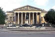
In the early 19th century, the romantic medieval gothic style appeared, partially as a reaction against the symmetry of Palladianism, and can be seen in buildings such as the Bristol City Museum and Art Gallery,[70] the Royal West of England Academy,[71] and The Victoria Rooms.
The plaque was meant to replace an original which made no reference to Edward Colston's past with the Royal African Company and the Bristol Slave Trade.
[113] Covering Bristol and the rest of the old Avon county with the exception of North Somerset, the new combined authority has responsibility for regional planning, roads, and local transport, and to a lesser extent, education and business investment.
[114] This "seaward extension" can be traced back to the original boundary of the County of Bristol laid out in the charter[115] granted to the city by Edward III in 1373.
The Atlantic Ocean influences Bristol's weather, keeping its average temperature above freezing throughout the year, but winter frosts are frequent and snow occasionally falls from early November to late April.
[134] Although large cities in general experience an urban heat island effect, with warmer temperatures than their surrounding rural areas, this phenomenon is minimal in Bristol.
[138][139] Local initiatives include Sustrans (creators of the National Cycle Network, founded as Cyclebag in 1977)[140] and Resourcesaver, a non-profit business established in 1988 by Avon Friends of the Earth.
"[152] In terms of employment, the report found that "ethnic minorities are disadvantaged compared to white British people nationally, but this is to a greater extent in Bristol, particularly for black groups."
[156] In 2007 the European Spatial Planning Observation Network (ESPON) defined Bristol's functional urban area as including Weston-super-Mare, Bath and Clevedon with a total population of 1.04 million, the twelfth largest of the UK.
[162] One of the UK's most popular tourist destinations, Bristol was selected in 2009 as one of the world's top-ten cities by international travel publishers Dorling Kindersley in their Eyewitness guides for young adults.
[184][185] A £500 million shopping centre, Cabot Circus, opened in 2008 amidst predictions by developers and politicians that the city would become one of England's top ten retail destinations.
With a highly skilled workforce drawn from its universities, Bristol claims to have the largest cluster of computer chip designers and manufacturers outside Silicon Valley [citation needed].
[249] Bristol City Women were formerly based at Twerton Park, but now share Ashton Gate as a home venue with the men's team and occasionally relocate to The Robins High Performance Centre in Failand for cup games.
[278] Linguist Stanley Ellis, who found that many dialect words in the Filton area were linked to aerospace work, described Bristolian as "a cranky, crazy, crab-apple tree of language and with the sharpest, juiciest flavour that I've heard for a long time".
[288][289][290] Bristol has been awarded Purple Flag status[291] on many of its districts, which shows that it meets or surpasses the standards of excellence in managing the evening and night-time economy.
[295] Equipped with a sound system and stage which are used every weekend for gigs of every genre, the bar and the connected Full Moon Pub were rated by The Guardian, a British daily paper, as one of the top ten clubs in the UK.
[315] Cecil Frank Powell was the Melvill Wills Professor of Physics at the University of Bristol when he received the 1950 Nobel Prize for, among other discoveries, his photographic method of studying nuclear processes.
Colin Pillinger[316] was the planetary scientist behind the Beagle 2 project, and neuropsychologist Richard Gregory founded the Exploratory (a hands-on science centre which was the predecessor of At-Bristol/We The Curious).
[317] Initiatives such as the Flying Start Challenge encourage an interest in science and engineering in Bristol secondary-school pupils; links with aerospace companies impart technical information and advance student understanding of design.
[336] In 2006, a project to develop a bus rapid transit system (BRT) named MetroBus was started,[337] with the purpose of providing a faster and more reliable service than buses, improving transport infrastructure and reducing congestion.