Brownhills
Brownhills quickly grew around the coal-mining industry, especially after the town became linked to the canal and railway networks in the mid-19th century.
By the end of the century, Brownhills had grown from a hamlet of only 300 inhabitants to a town of more than 13,000, of whom the vast majority were employed in the coal industry.
Mining remained the town's principal industry until the 1950s; the subsequent closure of the pits led to a severe economic decline that has continued until now.
[4] The settlement is first recorded (as "Brownhill") on Robert Plot's 1680 map of Staffordshire, at which time it was a hamlet within the manor of Ogley Hay, which in turn was part of the parish of Norton Canes.
[3] Charles Foster Cotterill, a former mayor of Walsall who had purchased the manor of Ogley Hay in 1836 upon the death of former lord Phineas Hussey, saw the potential of the area and sold off large tracts of his land for private farming and the construction of a flour mill and a foundry.
[2] In 1858 a branch line was constructed through the heart of what was then the hamlet of Brownhills, which led to a migration of the population eastwards, leading to the formation of mining slums in the Ogley Hay area.
[15][16] In 1877 the town of Brownhills was officially recognised for the first time after a new Act authorised the amalgamation of rural districts into larger local government areas.
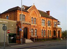
An order was issued on 29 September stating:[17] The Local Government Board have proposed to declare the Parish of Norton under Cannock, the Chapelry of Hammerwich, the Parish of Ogley Hay, and parts of the Parish of Shenstone and of the Township of Walsall Foreign to be a Local Government District under the name of the Brownhills District.After the First World War, the Urban District Council, which was based at the Council House and had replaced the District Board in 1894, began a programme of urban improvement.
Following the demise of the coalfield the town experienced a severe economic slump, with many high street shops closing down.
A wave of new development in the 1960s and 1970s saw a new shopping precinct planned, which it was claimed would incorporate a cinema, bowling alley, hotel, and bus station and would completely revitalise the town.
Despite the developers' grandiose claims, the project was not a success and ultimately consisted solely of shopping units, many of which stood empty for up to five years.
[22] Brownhills is represented by two tiers of government, Walsall Borough Council ("local") and UK Parliament ("national").
The district was amalgamated in 1974, under the Local Government Act 1972, into the newly formed Metropolitan Borough of Walsall, under whose jurisdiction the area remains to this day.
[27] The highest point of Cannock Chase, standing at 244 metres (801 ft) above sea level,[28] lies approximately 4 miles (6 km) from the town.
[30] Immediately to the west of the town is Brownhills Common, a 100-acre (0.40 km2) heathland which once formed part of Cannock Forest (also known as "Canke Wood").
[31] Although the forest was felled in the 15th and 16th centuries, the spread of heather and the grazing of sheep led to the creation of a huge area of heathland.
[32] The area now supports various habitat types, with the heathland mixing with marshy grassland, with scattered scrub and pools.
[33] In 1926, when ownership of the Common was transferred to the local Council, a large area of barren land at the eastern end, closest to the town, was landscaped, with new trees planted.
[35] In 2007, a new £445,000 bridge was erected across the canal at Brownhills, providing pedestrian, disabled and cycling access to the Common and to the village of Clayhanger beyond.
[37] The geology of Brownhills comprises mainly red clay marl overlying Triassic sandstone and deposits of coal.
[42] In late 2020 the average selling price of a domestic property in the town was £182,700, compared to £112,000 ten years earlier, a rise of 63%.
[20] In 2007, the local authority created a "Townscape Masterplan" for the regeneration of Brownhills, which involved increased leisure provision, the improvement of the town centre's shopping facilities, a new transport interchange incorporating Park and Ride facilities and cycle links to the town centre and the National Cycle Route, and the refurbishment of run-down properties.
[27] National Express West Midlands bus services 936, 937, 937A connect the town with Kingstanding, Perry Barr and Birmingham.
[57] Andy Street, the Mayor of the West Midlands, put forward a 20-year plan for the improvement of the region's transport infrastructure in 2020 which included the re-opening of a station in Brownhills.
[62] Watling Street Primary School, situated on the A5 at the western end of town, has approximately 200 students between the ages of 3 and 11 as of 2021.
[73] On the opposite side of the A5, Brownhills Common, where a wide variety of birds can be observed, is a designated nature reserve,[74] as is Shire Oak Park, approximately 0.9 miles (1.4 km) from the town centre.
[82] The town had a weekly market for many years, but it closed down in 2010 due to lack of traders and the site was subsequently redeveloped for housing.
Although some older ones, such as the Victorian-era Jolly Collier in Coppice Side, were demolished in the 1980s,[84] several dating from the 19th century still stand comparatively unchanged, including the Shoulder of Mutton, which still bears windows etched with the emblem of the brewery which owned it in the 1850s.