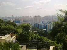
Bukit Merah
A young boy named Hang Nadim proposed an ingenious solution, to build a wall of banana stems along the coast at the present location of Tanjong Pagar.
With the swordfish problem solved, Hang Nadim earned great respect from the people, but also jealousy from the rulers.
During its existence, a Chinese cemetery was situated on the reverse side of this hill, which is today, the location of Tiong Bahru.
The two rock outcrops were subsequently blown up by the Straits Settlements Surveyor, John Thomson, in August 1848 to widen the entrance a new harbour.
With the earliest records of Bukit Merah's existence in the Malay Annals, the town had a huge role to play in the early maritime trade of the Kingdom of Singapura.
[7] The town's fertile red soil was employed to great effect when it was a district rich in gambier cultivation during British colonial rule.
[8] Even before the industrialisation of Jurong, Bukit Merah already had a small head start in the emerging heavy industry market in Singapore.
There are 17[10] subzones within the planning area, including Alexandra, Bukit Ho Swee, Bukit Merah, City Terminals, Depot Road, Everton Park, HarbourFront, Henderson Hill, Redhill, Singapore General Hospital, Telok Blangah and Tiong Bahru.
The Kampong Bahru Bus Terminal is located along Spooner Road, near the vicinity of the Singapore General Hospital.