Bundaberg
[1][6] The district surveyor, John Thompson Charlton designed the city layout in 1868, which planned for uniform square blocks with wide main streets, and named it ‘Bundaberg’.
[7] An early influence on the development of Bundaberg came with the 1868 Land Act, which was a famous Queensland via media, that aimed to create a class of Australian yeoman.
[8] Large sugarcane plantations were established throughout the 1880s, with industries of sugar mills, refineries, and rum distilleries that delivered prosperity to Bundaberg.
[9] These plantations used South Sea Islanders as indentured labourers, many of whom were blackbirded, a practice considered of form of slavery.
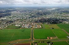
[15] The economy of Bundaberg is based primarily on agriculture, forestry, fishing and tourism, with a gross regional product at about $5.62 billion as of June 2023.
[20] It is also a German word which translates as "mountain", and refers to the Sloping Hummoch, the singular hill rising above the relatively flat region surrounding the Burnett River on which the city is situated.
[22] A pioneer pastoralist of the region, Nicholas Tooth, wrote that "Bourbong" was derived from the local Aboriginal phrase "bier rabong", meaning "plenty dead".
Tooth, who took up land in the area in the early 1860s, found that Aboriginal people resolutely avoided the "bier rabong" vicinity.
[28][29] British occupation of the land in the region began in 1848 when pastoral squatters Gregory Blaxland Jnr and William Forster established a sheep station.
They selected a very large area of land which encompassed most of the western part of the modern day Bundaberg Region along the Burnett River.
Blaxland and Forster had previously set up sheep stations near the Clarence River and had a notable history of conflict with Aboriginal people.
Forster and a number of other squatters conducted another reprisal, resulting in a large massacre of Aboriginal people in scrubland toward the coastal part of Tirroan.
At the same time, Native Police officer, Richard Purvis Marshall, took up the Bingera leasehold in the rainforest scrubland downstream from Tirroan.
[31][32] Before colonisation, much of the land around the lower reaches of the Burnett River consisted of either the Woongarra Scrub, a subtropical rainforest that stood where most of the Bundaberg canefields now grow, or the Barolin Plains, a lightly timbered grassland that stretched along the coastal fringe.
[36] In 1867, timber-getters and farmers, John and Gavin Steuart, established the Woondooma property which consisted of a few houses and a wharf on the northern banks of the Burnett River where Bundaberg North now stands.
[37][34] An official survey of the area was undertaken in 1869 by John Charlton Thompson,[34] assisted by James Ellwood and Alfred Dale Edwards,[38] and the town of Bundaberg was gazetted across the river on the higher, southern banks.
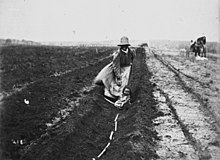
The initial 35 years of the sugar industry in Bundaberg was reliant on South Sea Islander workers, who were often blackbirded and kept in a status close to slavery.
[44] Influential Bundaberg plantation owners were able to purchase recruiting ships in order to obtain labour directly from areas such as the Solomon Islands and the New Hebrides.
The Young Brothers owned the Lochiel and the May vessels,[45][46] the Cran family and Frederic Buss were the major investors in the Helena while the Ariel was co-owned by a number of local planters.
Overwork, poor housing, inadequate food, contaminated water supplies and a lack of medical care all contributed to the high death rate.
[50][51] Importing South Sea Islander labour was made illegal in 1904 and enforced repatriation of these workers out of Bundaberg and other locations in Queensland occurred from 1906 to 1908.
[58] In 1912 Bundaberg pioneering aviator Bert Hinkler built and successfully flew his own glider on Mon Repos beach.
The following year in 1921 Hinkler flew from Sydney to Bundaberg, non-stop, in a record breaking flight of 8 and a half hours, in the process beating a telegram he had sent to his mother, to warn her of his arrival.
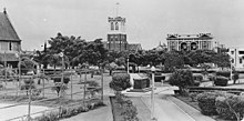
[62] In 1941 the Sisters of Mercy purchased the house Brabourne (originally owned by prominent citizen Frederick Buss) and established St Mary's Hostel, for women and girls working in or visiting Bundaberg.
The hospital expanded over the years with additional beds, operating theatres, X-ray, pathology and a dedicated children's ward.
In December 2010, Bundaberg suffered its worst floods in 60 years, when floodwaters from the Burnett River inundated hundreds of homes.
[65] Two defence force Blackhawk helicopters were brought in from Townsville as part of the evacuation operation, which ultimately used an additional 14 aircraft.
However, the hostels and farms have received huge criticism in the press and on social media due to the treatment some backpackers have faced.
[98][99] The Courier-Mail have reported claims of poor living conditions, underpayment and allegations of sexual abuse which they say has led to backpackers warning others about working hostels in Bundaberg.
[105] Opened in 2002 by the former member for Hinkler Paul Neville, the Tom Quinn Community Centre gardens (a multiple "Bundy in Bloom" winner) is a site to be seen with local flora and fauna, its own cafe, marketplace, chapel, green house, training facilities, woodwork and indigenous nature section.