Buren
It is part of the landscape of Betuwe, a very fertile strip of land between two branches of Rhine-Meuse Delta, the Nederrijn in the north and the Waal in the south.
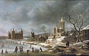
The town was granted city rights in 1395 by Sir Alard IV of Buren which led to the construction of a defensive wall and a moat, significant portions of which still stand.
In 1492, the region was promoted to a county (i.e. a territory ruled by a count), but had limited economic influence due to its geographic isolation.
By 1574, the previously Catholic parish church of Saint-Lambert (Dutch: Sint Lambertus) had become Calvinist Reformed Protestant.
[citation needed] In 1853, following the end of his presidency, Van Buren made a visit to the town while on a tour of Europe and reportedly met with several distant relatives.