Burns Paiute Tribe
[2] Members of the tribe are primarily descendants of the Wadatika band of Northern Paiutes, who were hunter-gatherers traditionally living in Central and Southern Oregon.
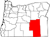
[3] Wadadökadö or Wadatika (Waadadikady): "Wada Root and Grass-seed Eaters", also known as Harney Valley Paiute, they controlled about 52,500 square miles (136,000 km2) along the shores of Malheur Lake, between the Cascade Range in central Oregon and the Payette Valley north of Boise, Idaho, as well as in the southern parts of the Blue Mountains in the vicinity of the headwaters of the Powder River, north of the John Day River, southward to the desertlike surroundings of Steens Mountain.
[3] The tribe also holds 71 scattered allotments about 25 miles (40 km) east of the Burns city limits.
[6] Traditionally, the Paiutes used willow, sagebrush, tule plant and Indian hemp to make baskets as well as sandals, fishing nets, and traps.
[1] Tribal employees are organized into nine departments, each dealing with a particular area, such as health, education, the environment and energy, cultural preservation and enhancement, and law enforcement.
[7] In 2009, the tribe became the first Native American community to complete full weatherization and installation of energy-efficient lightbulbs in all reservation housing.
[3] It included a casino, the Sa-Wa-Be Restaurant, a bingo hall, an arcade, a gift shop, conference facilities, an RV park, and other amenities.
[1][2][3] The tribe closed the casino on November 26, 2012, due to safety concerns stemming from structural problems with the building.