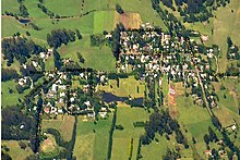
Burrawang, New South Wales
Burrawang (/ˈbʌrəwæŋ/ BURR-ə-wang) is a village in the Southern Highlands of New South Wales, Australia in Wingecarribee Shire.
He, along with his 58-year-old assistant Joseph Wild were mapping what is now known as the Moss Vale and Sutton Forest area and were commissioned to find an overland route from there to Jervis Bay as well as to plan and oversee the construction of a road to Goulburn Plains.
Surveyor Robert Hoddle and a gang of convicts cut a bridle path down the escarpment in 1830 as part of a track joining Cowpastures (Camden) to Kiama and Gerringong.
Sometime during this era the natural attributes of the Yarrawa Brush region came to their attention with its exotic rain forest and rich volcanic soil.
Major industries at the time included dairying, potatoes and vegetable growing, plus flour and timber milling.