Butaritari
Locally, Makin is the name of a separate but closest atoll, 3 kilometres (1.6 nmi; 1.9 mi) to the northeast of Butaritari, but close enough to be seen.
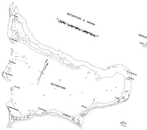
[1] The south and southeast portion of the atoll comprises a nearly continuous islet, broken only by a single, broad section of interislet reef.
[1] Seepage of saltwater into the pits in which babai (Cyrtosperma merkusii or giant swamp taro) is grown is the major concern of islanders.
[2] The erosion problems are identified as being linked to aggregate mining, land reclamation and the construction of causeways that is thought to change the currents along the shoreline.
Butaritari has the greatest potential for agriculture in Kiribati: bananas, breadfruit and papaya grow well, and successful cultivars of pumpkin, cabbage, cucumber, eggplant and other vegetables have been created with assistance from the Taiwan Technical Mission based in South Tarawa.
The people of Kuma village had the power to call dolphins or whales, and used this ability on special occasions to provide meat for important feasts such as the opening of a new maneaba.
[2] The earliest trading companies on Butaritari were the Hamburg-based Handels-und Plantagen-Gesellschaft der Südsee-Inseln zu Hamburg (DHPG) with Pacific headquarters in Samoa, and On Chong (Chinese traders with Australian connections via the goldfields).
Nakaeia was described by Stevenson as “a fellow of huge physical strength, masterful, violent … Alone in his islands it was he who dealt and profited; he was the planter and the merchant” with his subjects toiling in servitude and fear.
[12] Nakaeia allowed two San Francisco trading firms to operate, Messrs. Crawford and Messrs. Wightman Brothers, with up to 12 Europeans resident on islands of the atolls.
Stevenson adopted the strategy of describing himself as the son of Queen Victoria so as to ensure that he would be treated as a person who should not be threatened or harmed.
[13] The Japanese trading company Nanyo Boeki Kabushiki Kaisha established operations in Butaritari Village.
Eventually On Chong was taken over by W. R. Carpenter & Co. On 10 December 1941, three days after the attack on Pearl Harbor, 300 Japanese troops, plus laborers of the "Gilberts Invasion Special Landing Force" arrived off Butaritari — then known as "Makin" — and occupied without resistance.
Butaritari's land defenses were centered around the lagoon shore, near the seaplane base in the central part of the island.
Without aircraft, ships, or hope of reinforcement or relief, the outnumbered and outgunned defenders could only try to delay the American attack for as long as possible.
Despite their great superiority in men and weapons, the Americans had considerable difficulty subduing the island's small defensive force.
The runway of Butaritari Atoll Airport was originally built as the World War II American strip (Starmann Field).
There are three guesthouses on Butaritari, providing a basic level of accommodation aimed mainly at government staff and visitors, though tourists are welcomed.